Plavecké Podhradie
Plavecké Podhradie Bratislava county Slovakia
monastery
Plavecké Podhradie
Plavecké Podhradie Bratislavský kraj Slovakia
kláštor
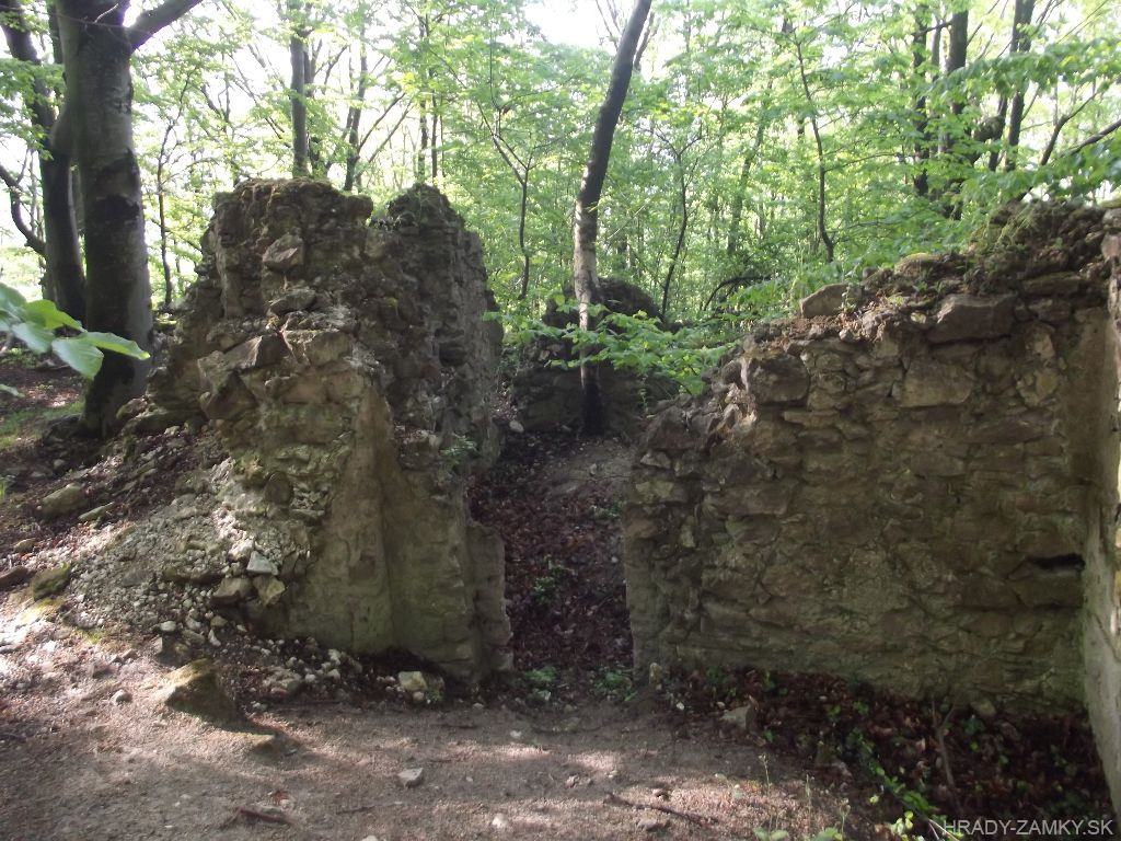
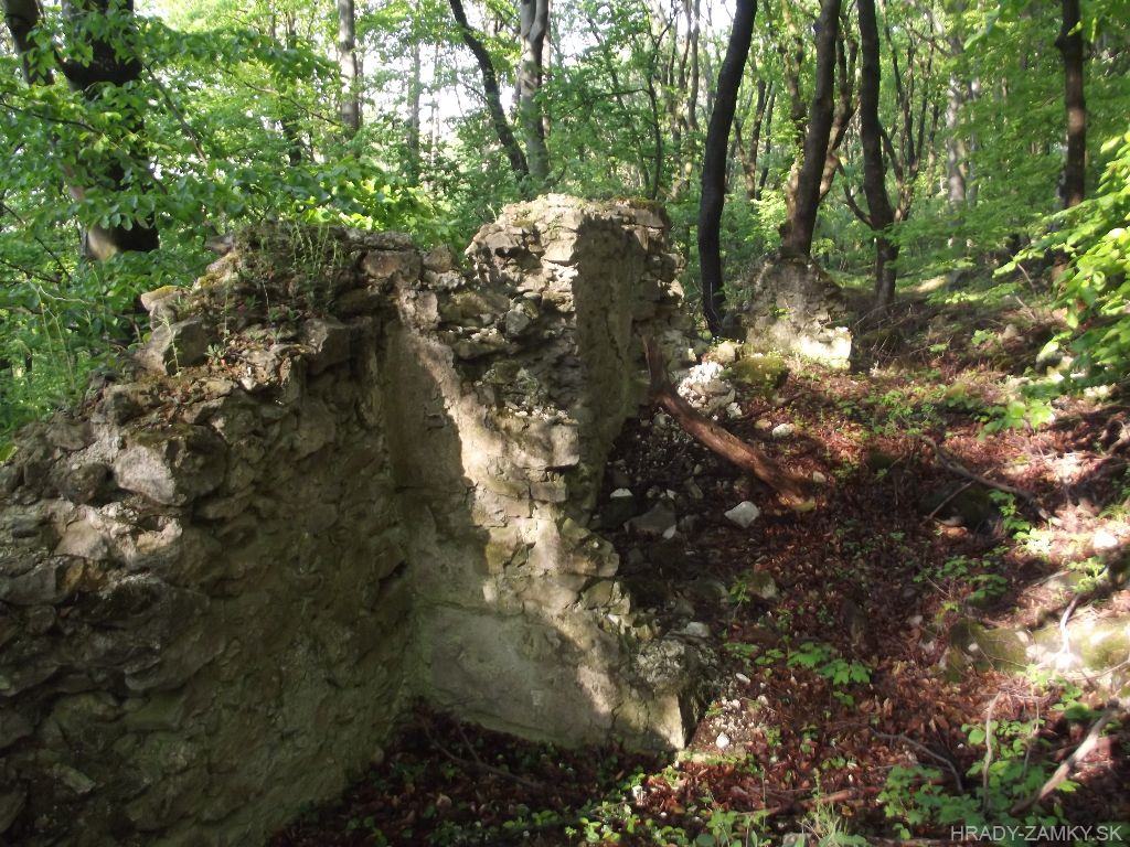
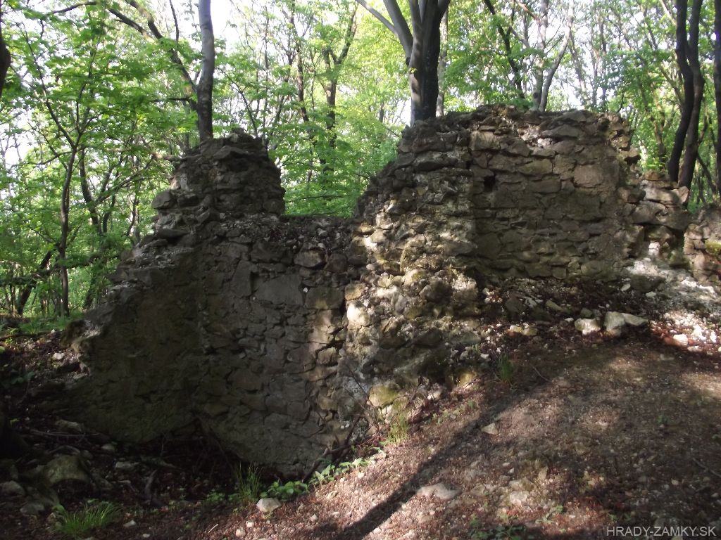
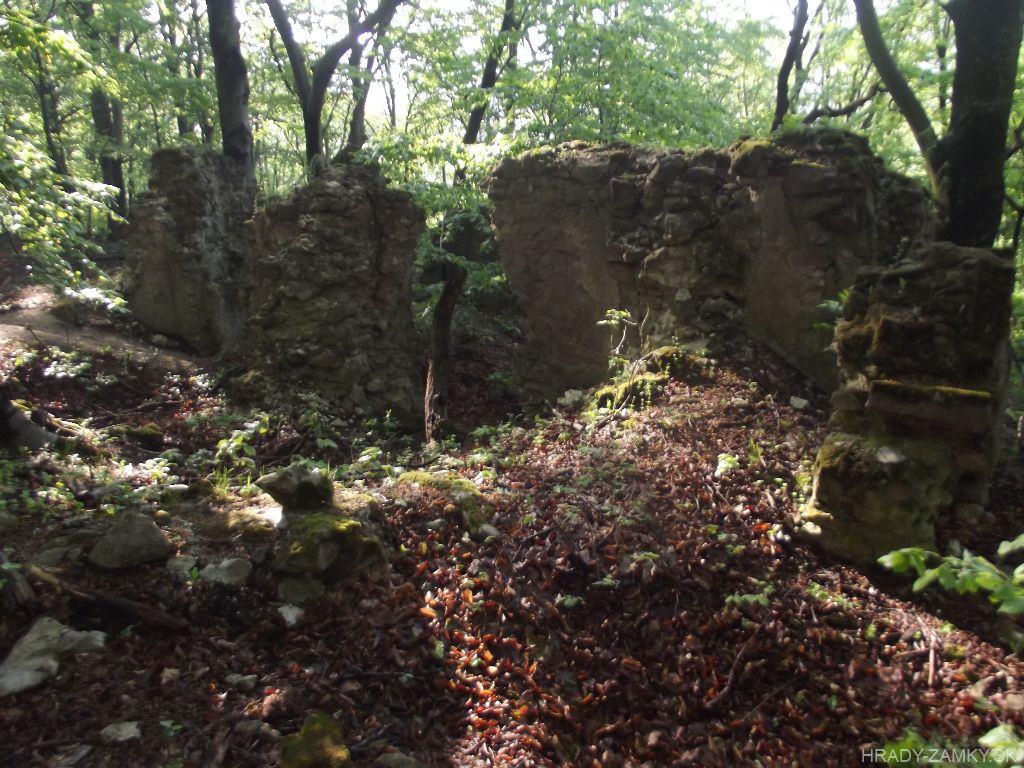
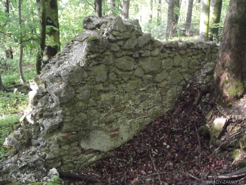
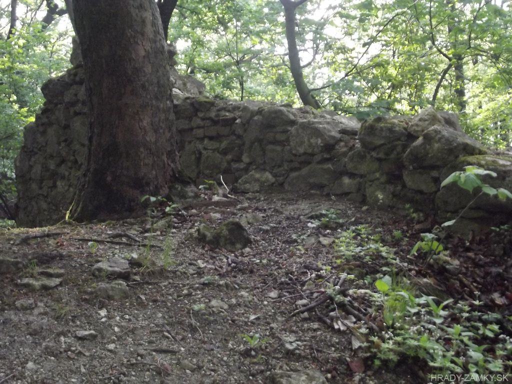
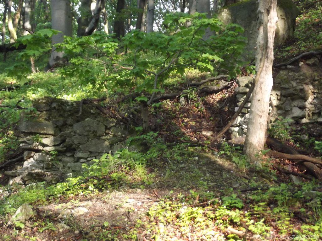
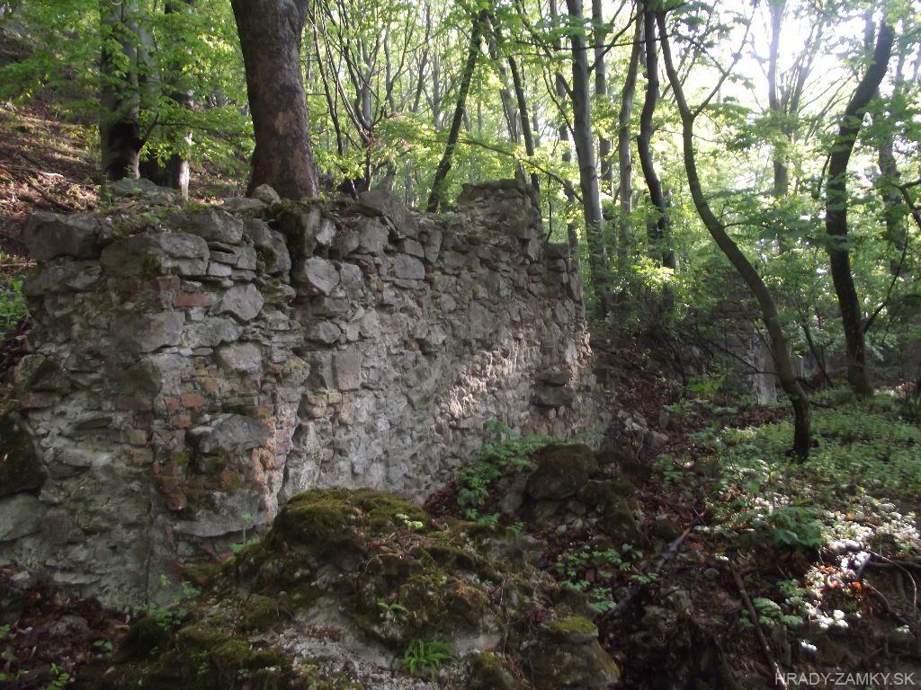
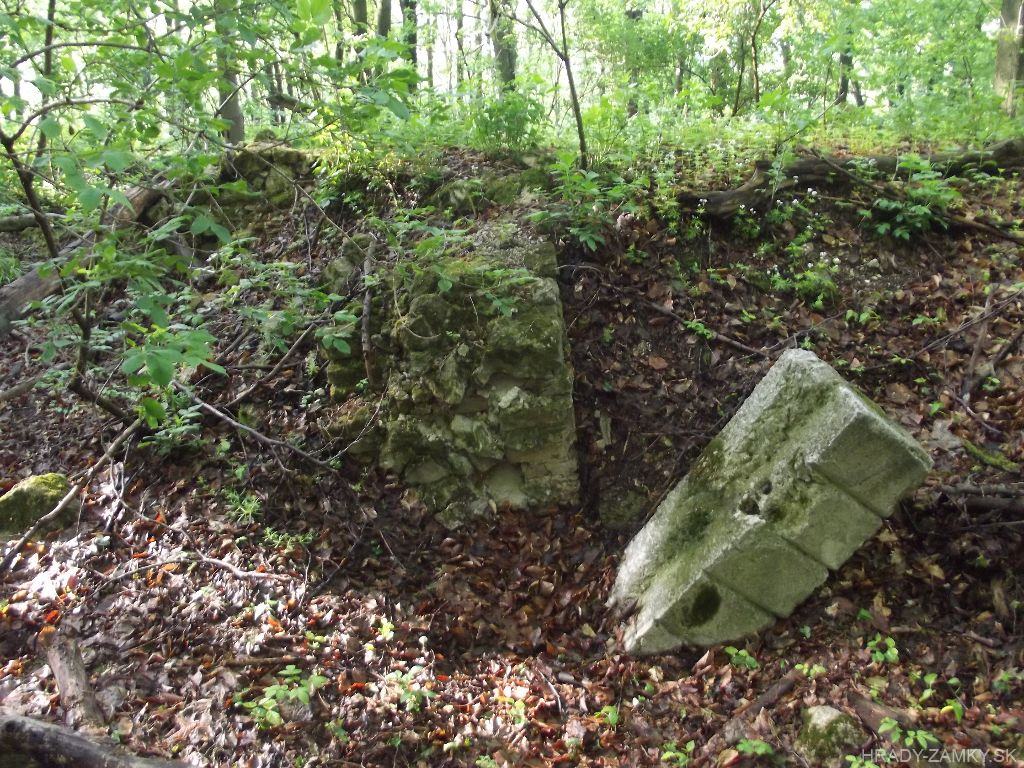
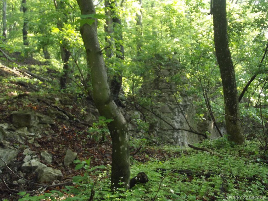
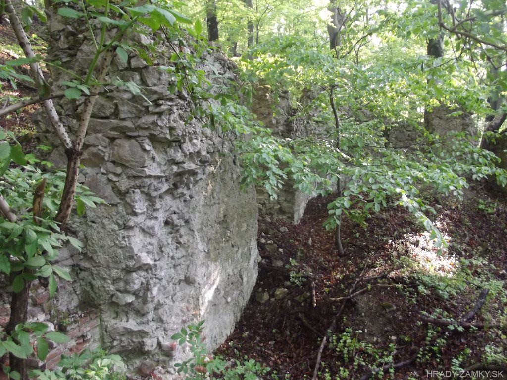
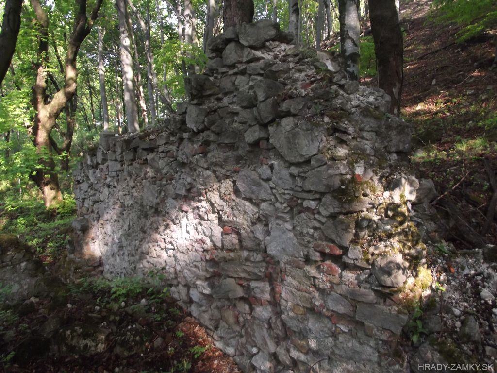
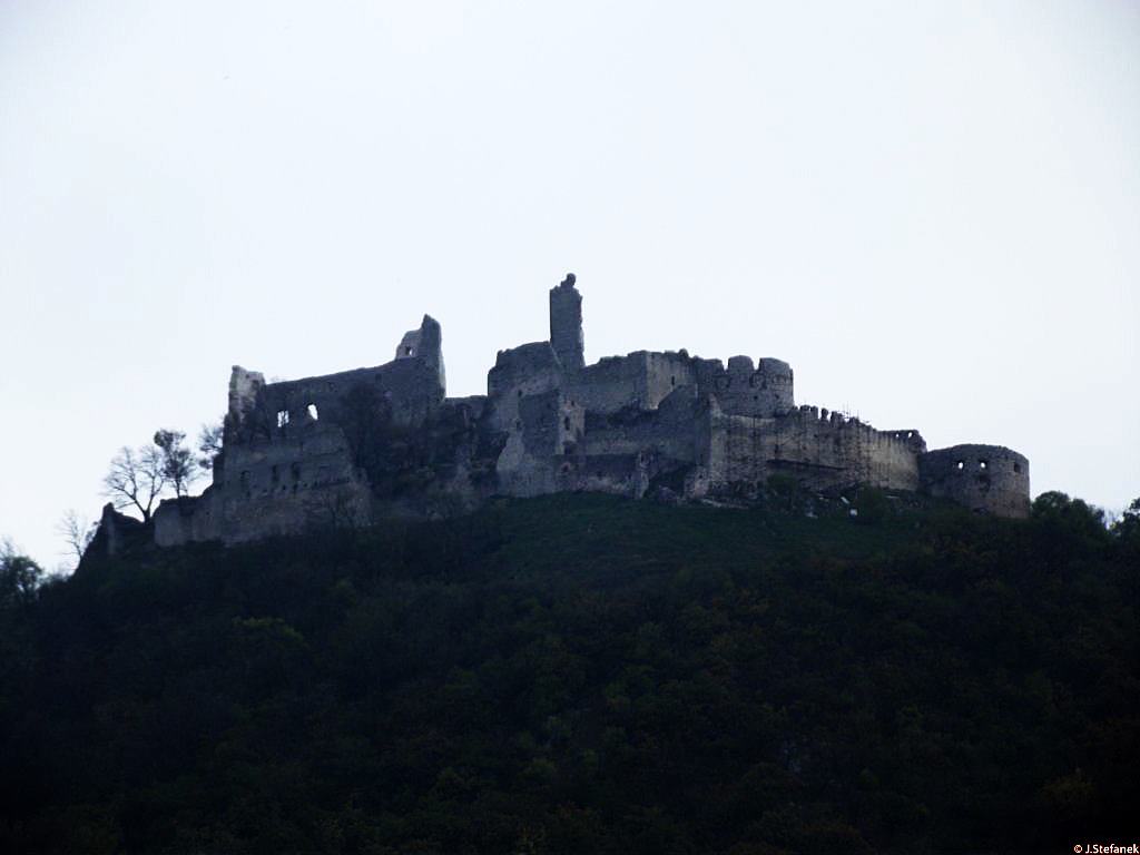
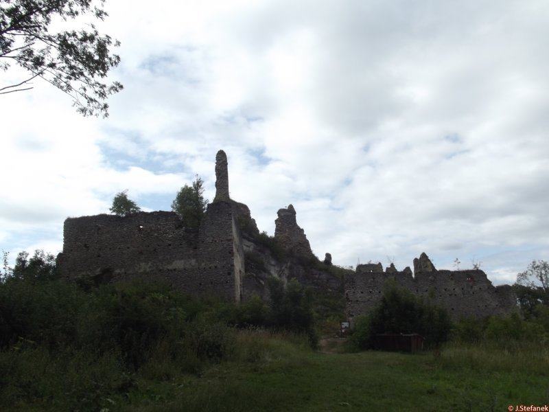
Remains of the perimeter walls of the extinct monastery above Plavecké Podhradie, at the southern foot of Pohanská hill
Zvyšky obvodových múrov zaniknutého kláštora nad obcou Plavecké Podhradie, na južnom úpätí kopca Pohanská.
Previous names
Roads
We can approach the remains of the monastery in Plavecké Podhradie we get directly from the village Plavecké Podhradie. From the road No. 1110, which passes through the village, we get to the kindergarten next to the church of St. Barbora. We park here and continue around the nursery on foot and continue along the path to the right until we reach the meadow. Follow it north, still straight to the edge of the forest. There is no marked path, but the monastery is not very deep in the forest. After entering the forest we go straight, we come across a bench, then we go to the ruins next to the spring.
K zvyškom kláštora v Plaveckom Podhradí sa dostaneme priamo z obce Plavecké Podhradie. Z cesty č.1110, ktorá obcou prechádza sa dostaneme k materskej škole vedľa kostola sv. Barbory. Tu zaparkujeme a ďalej už peši obídeme škôlku a pokračujeme cestičkou vpravo až prídeme k lúke. Po nej pokračujeme na sever, stále rovno až na okraj lesa. Nie je tu žiadna vyznačená cesta, no kláštor nie je veľmi hlboko v lese. Po vstupe do lesa pôjdeme rovno, natrafíme na lavičku, potom popri prameni dôjdeme k zrúcaninám.
Description
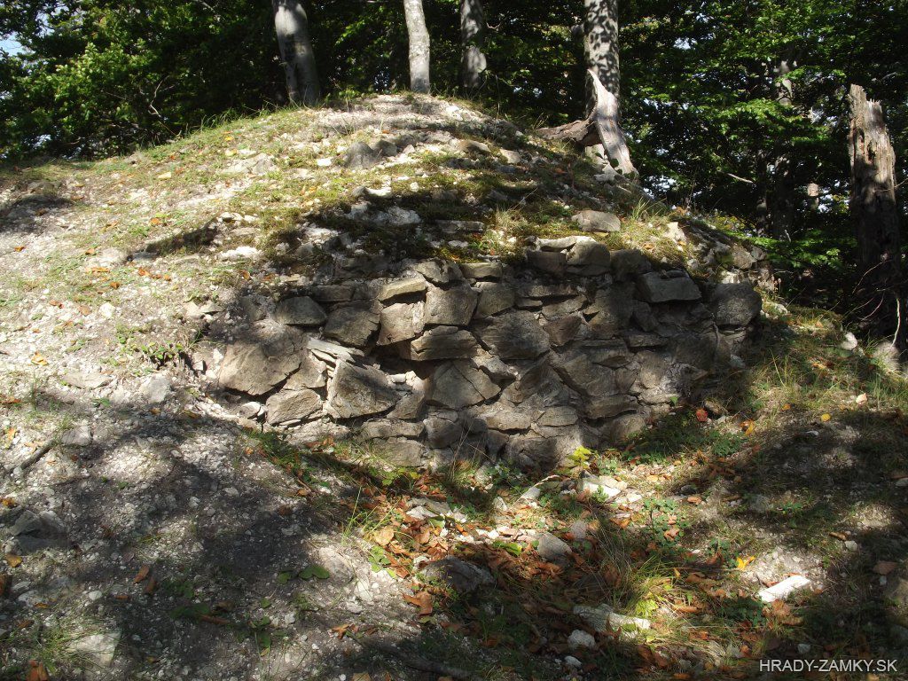
The monastery was originally a Gothic church. Currently, the best preserved is the Gothic part and defensive walls. The church was built on the southern foot of the hill Pohanská in the area of the Celtic oppida sometime during the 14th century. It was a small object with a polygonal presbytery of the same width as the ship and the northern, probably square sacristy. Its statics were provided by supporting pillars in the corners.The building is probably the last monument to the unknown extinct village that was located in this place. The orientation of the church is exactly in the east-west direction. The width of the perimeter masonry is 100 cm, with an amplification of 120 cm on the north side, probably due to the entrance to the sacristy, which is located here.
Súčasťou kláštora bol pôvodne gotický kostolík. V súčasnosti sa najlepšie zachovala gotická časť a obranné múry. Kostolík postavili na južnom úpätí kopca Pohanská v areáli keltského oppida niekedy v priebehu 14. storočia. Išlo o neveľký objekt s polygonálnym presbytériom rovnakej šírky ako loď a severnou, zrejme štvorcovou sakristiou. Jeho statiku zabezpečovali oporné piliere v nárožiach.Stavba je pravdepodobne posledným pamätníkom neznámej zaniknutej dediny, ktorá sa nachádzala na tomto mieste. Orientácia kostolíka je presne v smere východ - západ. Šírka obvodového muriva je 100 cm, so zosilnením na 120 cm na severnej strane, asi kvôli vchodu do sakristie, ktorý sa tu nachádza.
History
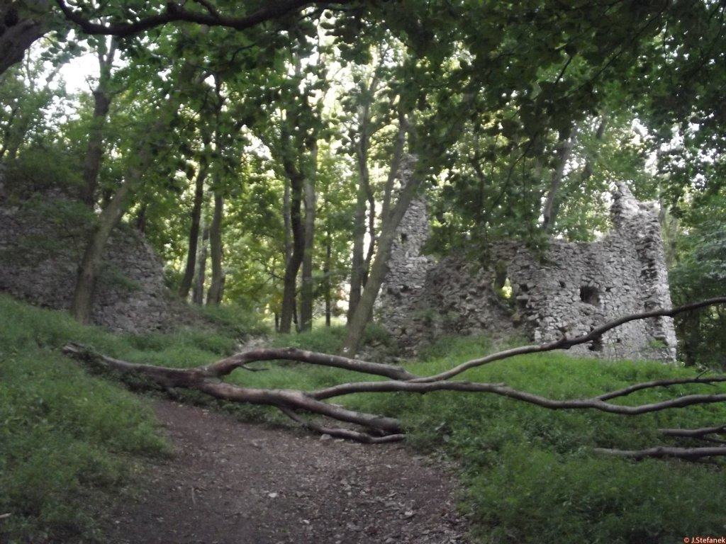
From the defunct monastery above the village of Plavecké Podhradie, only the remnants of the perimeter walls have been preserved. The monastery originally included a Gothic church dating back to the 14th century.
In the 16th century, the church was extended by the addition of a larger Renaissance nave with brick paving, apparently for the needs of the monastic community. In the 18th century, a brick tower with a square floor plan was added to the western façade of the nave, completing the architectural development of the building.
It is not clear when the church disappeared, on the map from the first military mapping in the 18th century, an object marked with a cross is still shown in these places. In addition, a landslide damaged the site at the beginning of the 20th century. The research of the building took place in 1967 and was led by archaeologist Karol Kulašík, whose research helped to clarify the history of the building and brought discoveries of several architectural elements (such as a stone baptistery with a Gothic foot and a Renaissance bowl or pilasters from a nave).
At present, the remains of the building and the defensive wall are unmaintained and no official tourist route leads to them.
Zo zaniknutého kláštora nad obcou Plavecké Podhradie sa zachovali už len zvyšky obvodových múrov. Súčasťou kláštora bol pôvodne gotický kostolík datovaný do 14. storočia.
V 16. storočí bol kostolík rozšírený prístavbou väčšej renesančnej lode s tehlovou dlažbou, podľa všetkého pre potreby kláštornej komunity. V 18. storočí pristavali k západnému priečeliu lode tehlovú vežu štvorcového pôdorysu, čím sa zavŕšil architektonický vývoj stavby.
Nie je jasné, kedy kostol zanikol, na mape z prvého vojenského mapovania v 18. storočí je približne v týchto miestach ešte znázornený objekt označený krížom. Začiatkom 20. storočia lokalitu navyše poškodil zosuv pôdy. Výskum objektu sa uskutočnil až v roku 1967 a viedol ho archeológ Karol Kulašík, ktorého výskum pomohol objasniť históriu objektu a priniesol objavy viacerých architektonických prvkov (napr. kamenná krstiteľnica s gotickou nohou a renesančnou misou či pilastre z lode).
V súčasnosti sú zvyšky objektu a obrannému múru neudržiavané a nevedie k nim ani žiadna oficiálna turistická trasa.
Myths and legends
There are no myths available.
K tomuto objektu nie sú dostupné žiadne povesti
Useful information
The ruins are freely accessible
Zrúcanina je voľne prístupná
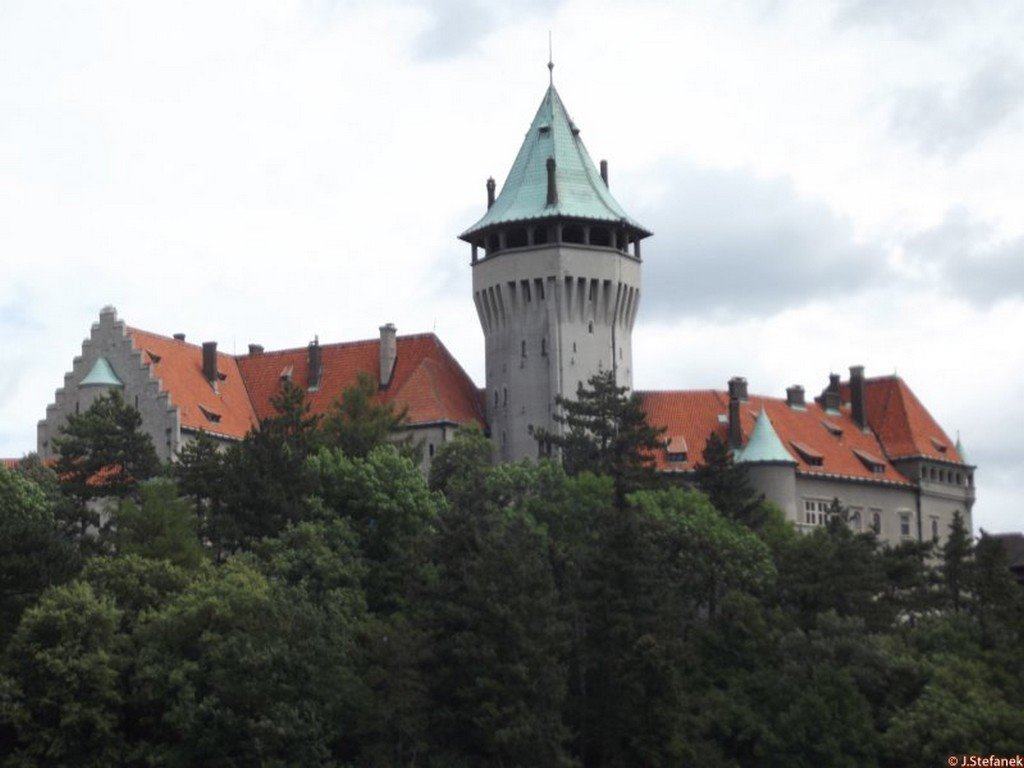
Nearby castles
Plavecký castle
Plavecké Podhradie
0.9km
castle ruin
Ostrý Kameň
Buková
8.3km
castle ruin
Kuchyňa castle
Kuchyňa
9.1km
castle ruin
Červený Kameň
Častá
11.5km
castle, chateau
Smolenice chateau
Smolenice
12.2km
castle, chateau
Korlátka
Cerová
12.9km
castle ruin
Trstín manor
Trstín
14.8km
manor, mansion