Thuisbrunn Castle
Oberfranken Bayern Germany
castle, chateau
Burg Thuisbrunn
Oberfranken Bayern Germany
castle, chateau
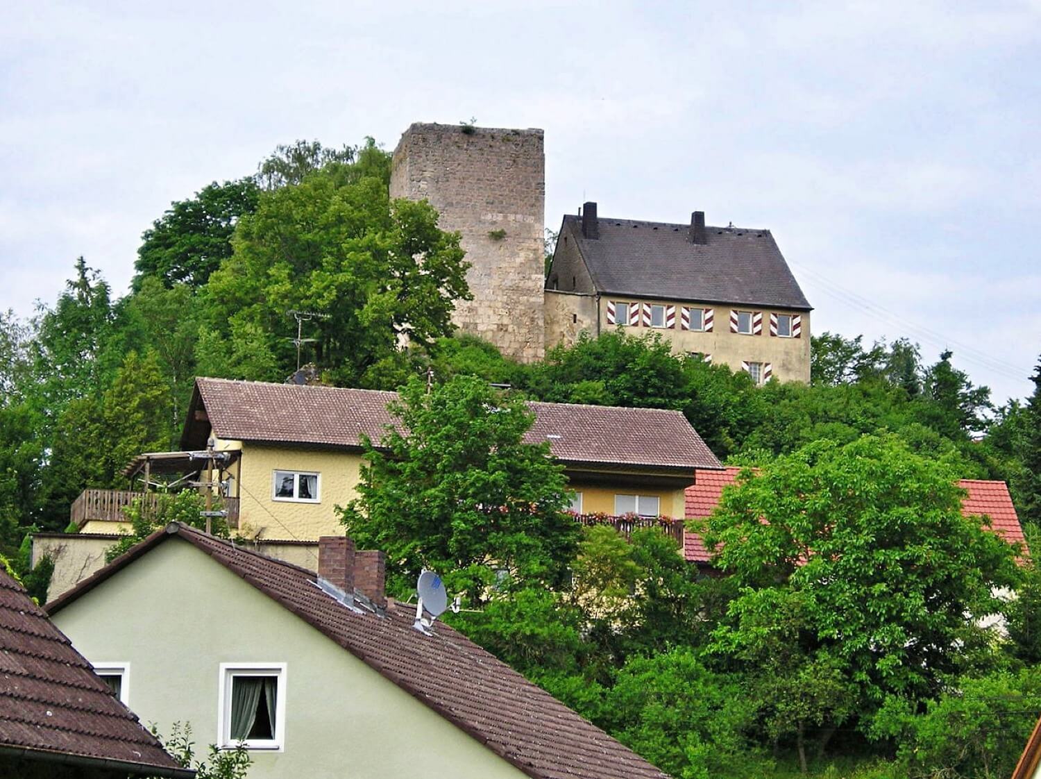
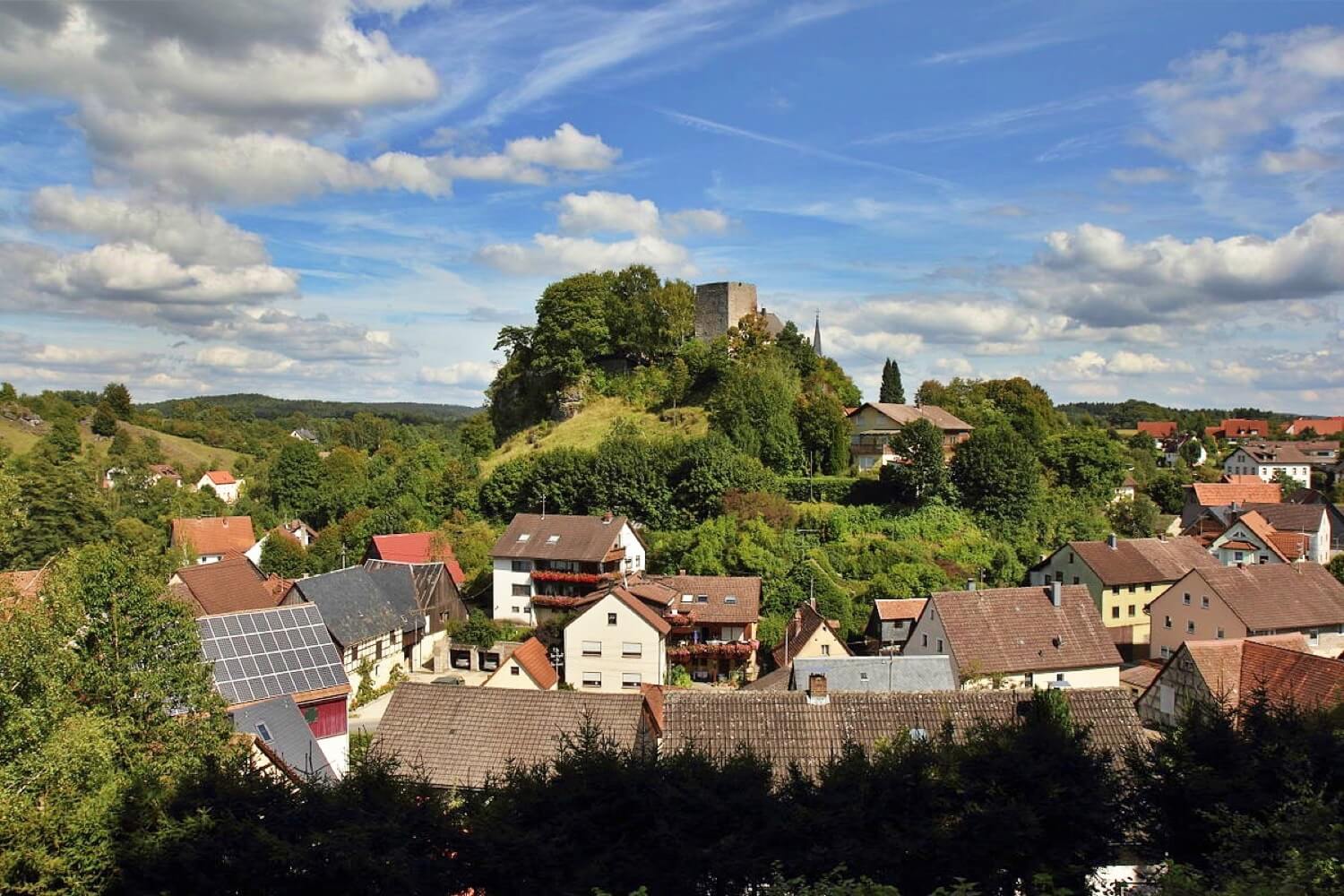
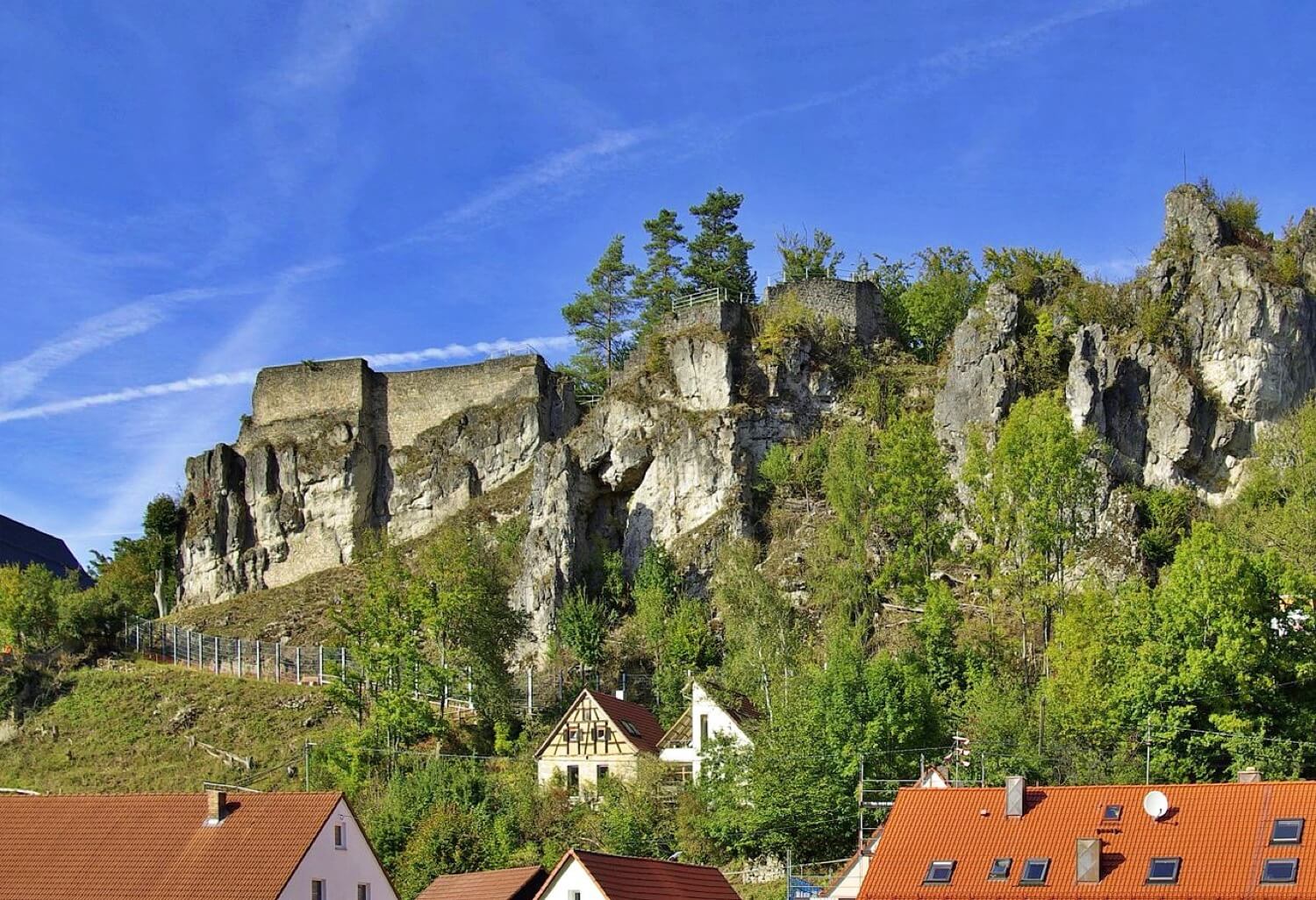
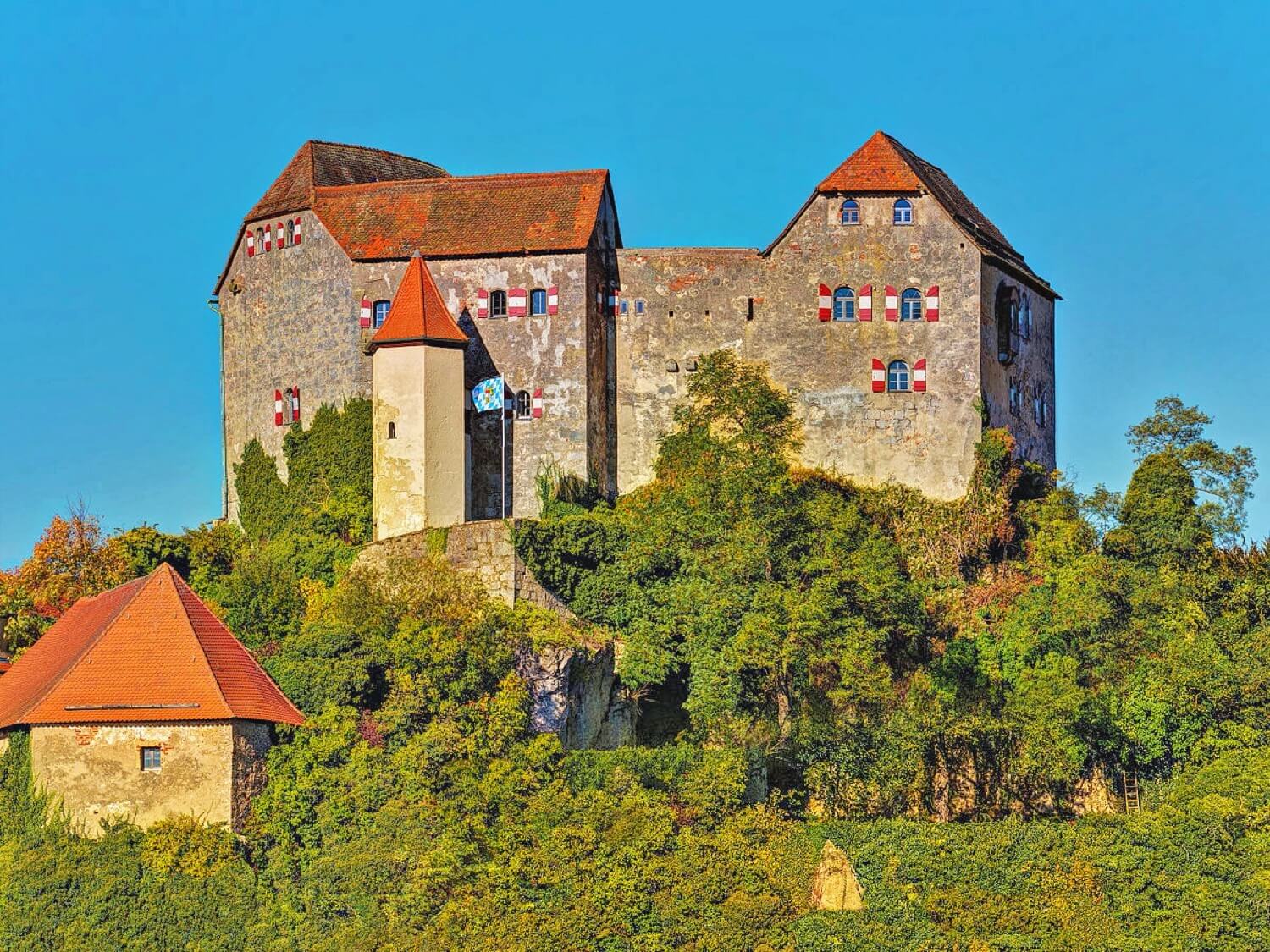
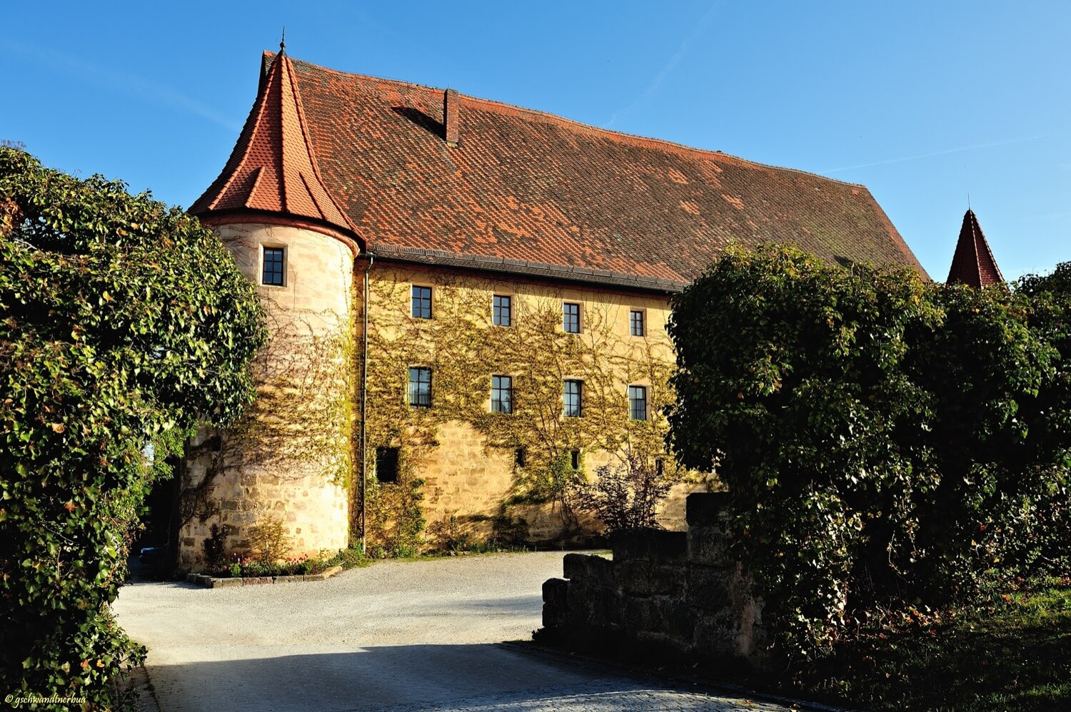
Thuisbrunn Castle (German: Burg Thuisbrunn) is located centrally within the parish of Thuisbrunn in the municipality of Gräfenberg in the Bavarian province of Upper Franconia
Die Burg Thuisbrunn liegt zentral im Ortsteil Thuisbrunn der Gemeinde Gräfenberg in Oberfranken
Previous names
Thuisbrunn Castle, Burg Thuisbrunn
Description
Thuisbrunn Castle (German: Burg Thuisbrunn) is located centrally within the parish of Thuisbrunn in the municipality of Gräfenberg in the Bavarian province of Upper Franconia. After having been destroyed and rebuilt several times, the castle is now in private ownership.
The spur castle was first mentioned in 1348 and Lord Hiltpolt of Mayenthal named as the castle lord (Burgherr) of Thuisbrunn. In 1388, during the South German War of the Cities, it was destroyed by Nuremberg troops and thereafter given to the burgraves of Nuremberg as a fief. In 1420 the castle was again wrecked during the Bavarian War by troops of Duke Louis of Ingolstadt. However, when the village of Thuisbrunn was destroyed in July 1449 by Nuremberg soldiers and again in 1460 during the Princes' War, the castle remained undamaged. In 1553, during the Second Margrave War, the castle was once more destroyed by Nuremberg troops. By 1558 only the district office (Amtshaus) and the bergfried had been rebuilt. During the Thirty Years' War and thereafter, Thuisbrunn and the castle were plundered seven times by Imperial, Swedish and Bavarian soldiers. In 1667, the Vogtei office was probably built in place of the old district office; apart from this house and the bergfried the castle remained a ruin. In 1816, the cartographer, Johann Christoph Stierlein, made for the first time a very precise map of the castle area and its surviving buildings. Following the seizure of the estates by the Kingdom of Bavaria in 1806 during the Napoleonic Era, the Vogtei office was used as a forestry office. Towards the end of the Second World War the castle was shelled by American troops. In 1961 it was sold into private ownership.
Die Burg Thuisbrunn liegt zentral im Ortsteil Thuisbrunn der Gemeinde Gräfenberg in Oberfranken. Nach mehrmaliger Zerstörung und Wiederaufbau ist die Burg in Privatbesitz.
1348 wurde die Spornburg erstmals erwähnt und als Burgherr Ritter Hiltpolt von Mayenthal zu Thuisbrunn genannt. Im Süddeutschen Städtekrieg wurde sie 1388 durch Nürnberger Truppen zerstört und danach den Nürnberger Burggrafen zu Lehen gegeben. 1420 wurde die Burg im Bayerischen Krieg durch Truppen Herzog Ludwigs von Ingolstadt erneut zerstört. Als das Dorf Thuisbrunn im Juli 1449 durch Nürnberger Truppen und im Fürstenkrieg 1460 zerstört wurde, blieb die Burg verschont. Im Zweiten Markgrafenkrieg wurde 1553 die Burg ein weiteres Mal durch Nürnberger Truppen zerstört. Bis 1558 wurden nur das Amtshaus und der Bergfried wieder aufgebaut. Im Dreißigjährigen Krieg und danach wurden Thuisbrunn und die Burg siebenmal durch kaiserliche, schwedische und bayerische Truppen geplündert. 1667 wurde das Vogteigebäude vermutlich anstelle des alten Amtshauses errichtet; außer diesem Haus und dem Bergfried blieb die Burg Ruine. Der Kartograph Johann Christoph Stierlein stellte 1816 eine erstmals sehr präzise Karte des Burgbereichs mit dem noch vorhandenen Bestand fertig. Nach der Übernahme der Besitzungen durch das Königreich Bayern 1806 diente das Vogteigebäude als Forsthaus. Gegen Ende des Zweiten Weltkrieges wurde die Burg durch amerikanische Truppen beschossen. 1961 ging sie in Privatbesitz über.
Useful information
Gratis
- Informationstafeln
- Gute Aussicht
Privateigentum, für Besucher geschlossen
-
Nearby castles
Egloffstein Castle
Oberfranken
1.7km
castle, chateau
Schloss Hundshaupten
Oberfranken
3.9km
castle, chateau
Wolfsberg Castle (Obertrubach)
Oberfranken
4.6km
castle, chateau
Hiltpoltstein Castle
Oberfranken
6.2km
castle, chateau
Bärnfels Castle
Oberfranken
7.5km
castle, chateau
Schloss Kunreuth
Oberfranken
7.7km
castle, chateau
Schloss Wiesenthau
Oberfranken
8.5km
castle, chateau