Čierny hrad
Zlatno Nitra county Slovakia
castle ruin
Čierny hrad
Zlatno Nitriansky kraj Slovakia
zrúcanina hradu
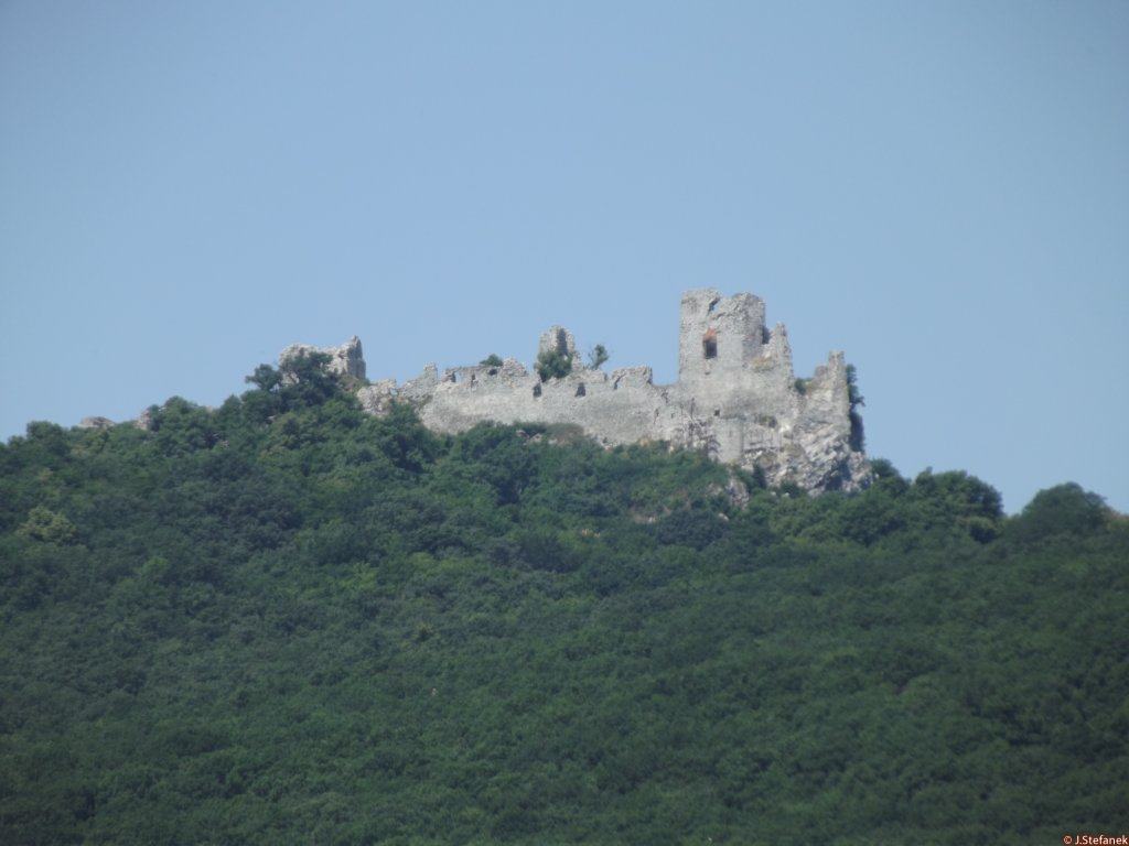
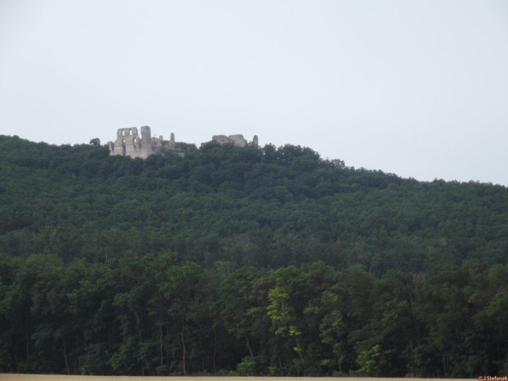
Smaller remains of the castle on the wooded outcrop of the Tríbeč mountain range, 2km from the village of Zlatno, northeast of Zlaté Moravce
Menšie zvyšky hradu na zalesnenom výbežku pohoria Tríbeč, 2km od obce Zlatno, severovýchodne od Zlatých Moraviec.


Previous names
Fekethewar, Fekete vár
Roads
Trasa 1: We will cross the whole village of Zlatno and continue straight along a narrow asphalt road, along the way we will see an information board about the castle. We continue straight on until we reach a crossroads, where there is a ramp with a no-entry sign and the road turns left here. We park here and continue on foot along the ramp. At first, the road is easy, about 15 minutes along the asphalt road, until we come to a turnoff to Black Castle. Here we have a 30-40 minute slightly challenging ascent and then a short final ascent to the castle.
Trasa 1: Prejdeme celou obcou Zlatno a pokračujeme stále rovno po úzkej asfaltovej ceste, cestou uvidíme informačnú tabuľu o hrade. Pokračujeme ďalej rovno, až prídeme k rázcestiu, kde sa nachádza rampa so zákazom vjazdu a cesta sa tu stáča aj doľava. Tu zaparkujeme a pokračujeme peši po ceste cez rampu. Spočiatku je cesta nenáročná, asi 15 minút po asfaltovej cestičke, až prídeme k odbočke na Čierny hrad. Tu nás čaká zhruba 30-40 minútový mierne náročný výstup a potom ešte krátky finálny výstup k hradu.
Trasa 2: From the mentioned crossroads we continue on foot or by bike on the asphalt road to the left, until we come to a turnoff to a forest path, which will lead us to the castle by an unmarked route. We can shorten the path a bit if we enter the field path through the meadow and then through the forest before the mentioned turn. This route will later be connected to the mentioned route.
Trasa 2: Zo spomínaného rázcestia pokračujeme peši alebo bicyklom asfaltkou doľava, až prídeme k odbočke na lesnú cestu, ktorá nás neznačenou trasou dovedie k hradu. Cestu si môžeme o niečo skrátiť, ak ešte pred spomínanou odbočkou vstúpime na poľnú cestu cez lúku a potom cez les. Táto trasa sa neskôr napojí na spomínanú trasu.
Description
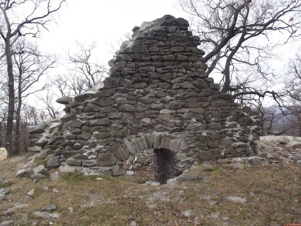
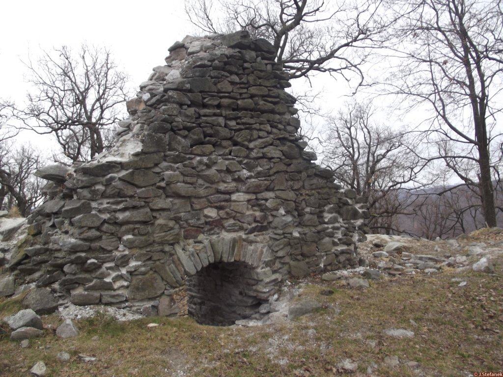
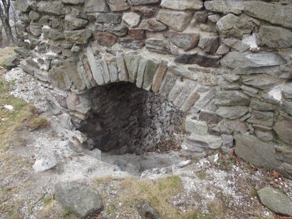
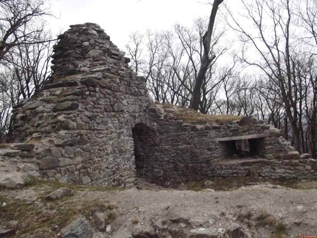
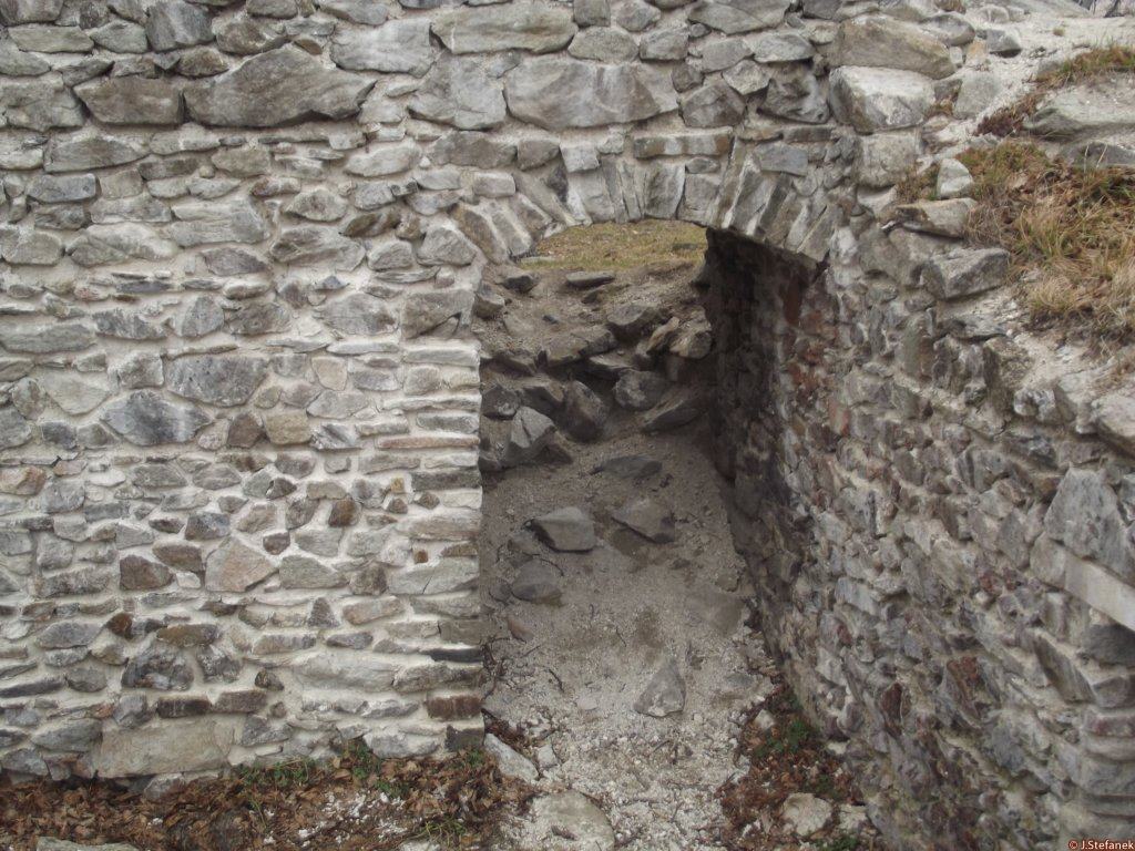
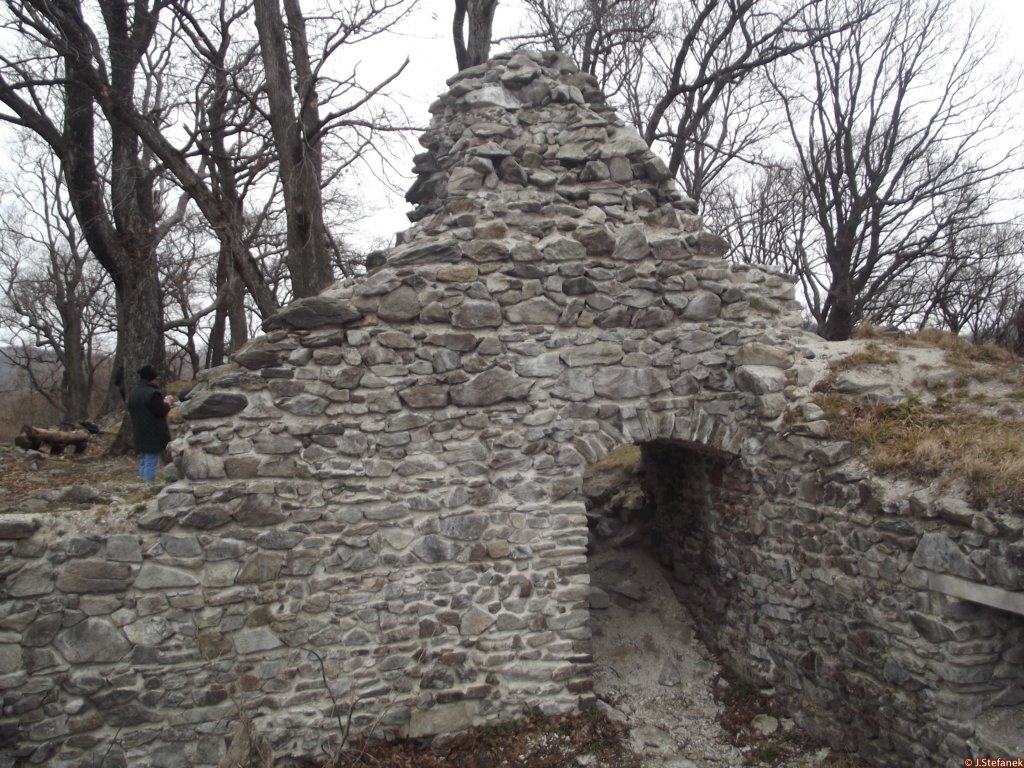
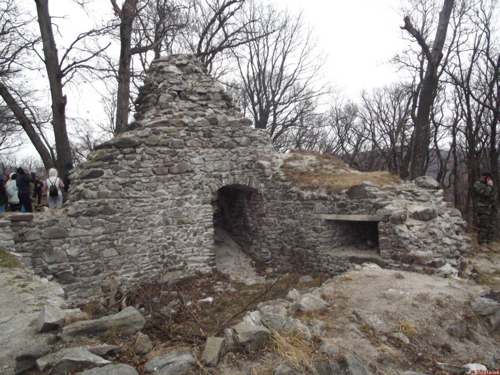
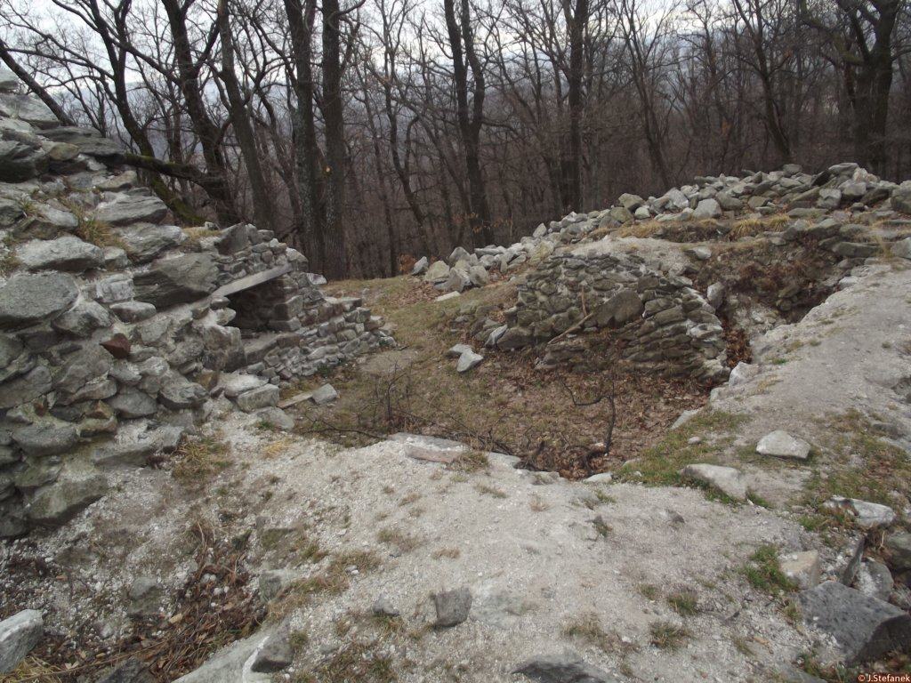
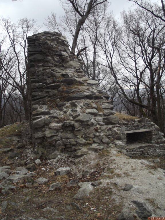
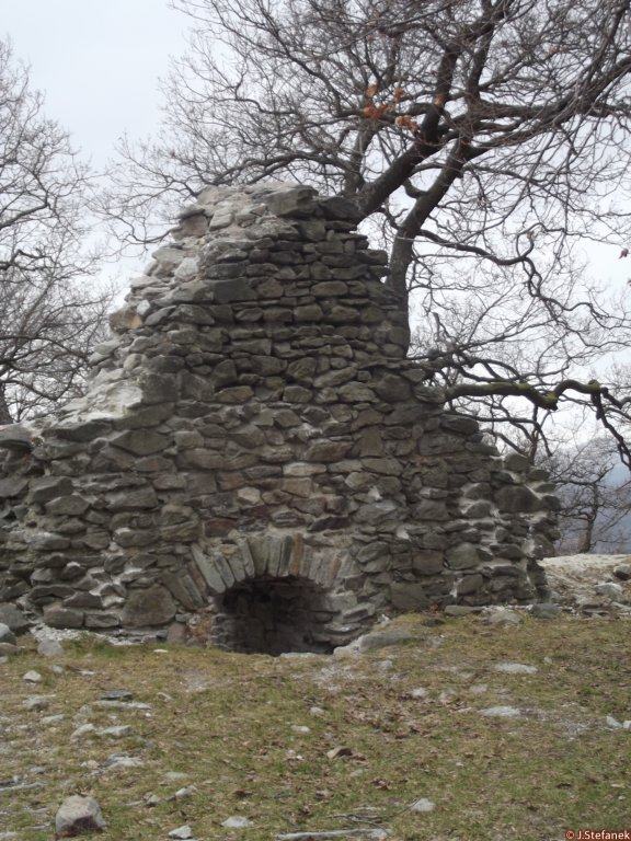
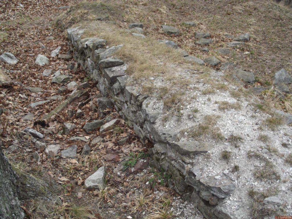
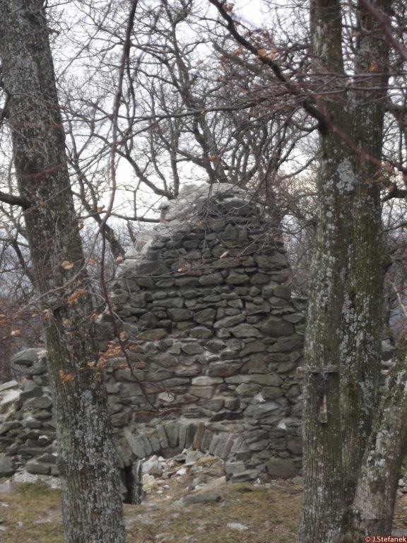
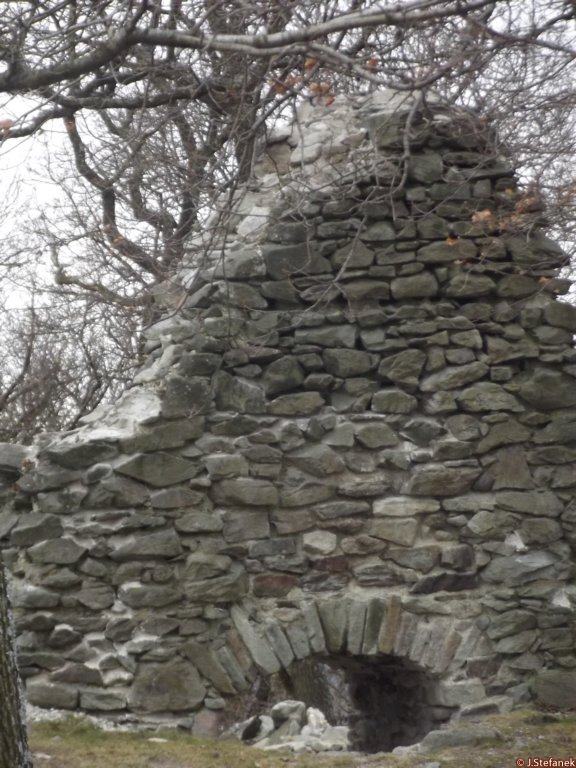
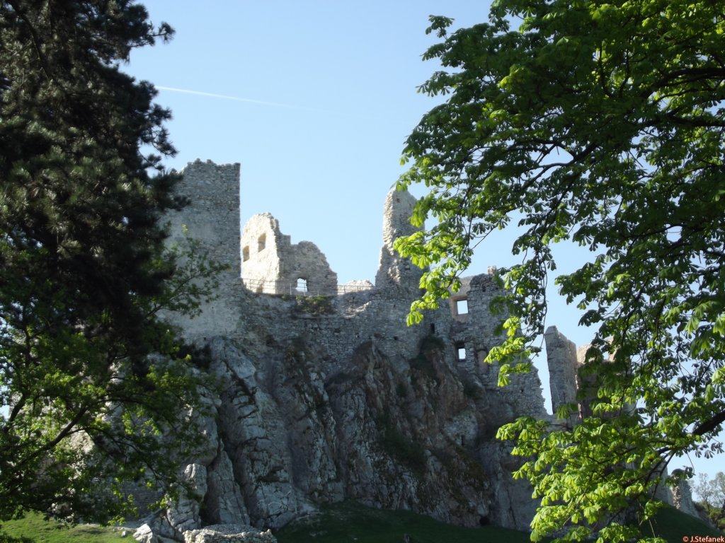
The castle area is an oval, bounded by a perimeter wall and an inner moat, oriented approximately north-south, with dimensions of approximately 95 m and 55 m. In the central part of the complex there is a rectangular stone core of the castle with dimensions of about 40 and 16 m. Only one fragment of the southern wall of the tower, about 2.3 m high, was preserved from the masonry. Other walls are extinct.The outer mounds and ditch are well preserved. The tank in the middle of the courtyard, which is currently about one meter deep, is well visible. According to the remnants of the masonry, terrain tracks and partial archaeological research from 2005 it can be assumed that in the southern part there was a prismatic tower whose dimensions can only be estimated at 8 x 8 m, while the masonry thickness was at least 1.8 m.
Areál hradu predstavuje ovál, ohraničený obvodovým valom a vnútornou priekopou, orientovaný približne severojužným smerom, s rozmermi približne 95 m a 55 m. V centrálnej časti areálu sa nachádza obdĺžnikové kamenné jadro hradu s rozmermi cca 40 a 16 m. Z muriva sa zachoval len jeden fragment južného múru veže vysoký okolo 2,3 m. Ostatné múry sú zaniknuté.Veľmi dobre sú zachované vonkajšie valy a priekopa. Dobre viditeľná je aj cisterna uprostred nádvoria, ktorá je v súčasnosti hlboká asi jeden meter. Podľa zvyškov murív, terénnych stôp a vykonaného čiastočného archeologického výskumu z roku 2005 možno predpokladať, že v južnej časti sa nachádzala hranolová veža, ktorej rozmery možno len odhadovať na 8 x 8 m, pričom hrúbka muriva bola minimálne 1,8 m.
Plan
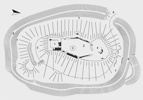
Legend to the ground plan
- 1 - defensive prismatic tower
- 2 - courtyard
- 3 - cistern
- 4 - palace building
- 5 - defensive wall
- 6 - probable entrance
- 7 - moat
- 8 - stone wall
Legenda k pôdorysu
- 1 - obranná hranolová veža
- 2 - nádvorie
- 3 - cisterna
- 4 - palácová stavba
- 5 - obranný val
- 6 - pravdepodobný vstup
- 7 - priekopa
- 8 - kamenná hradba
History
It is believed that Black Castle served to protect the gold-washing places in the nearby streams. In addition, it was important in the control and protection of the mountain road that leads from the village of Velčice to Solčiany. Almost no records of the history of the castle have been preserved. It was not until 2005, 2007 and 2009 that the first archaeological excavations were carried out at the castle, which helped to more accurately date the castle's existence and disposition. Based on these researches, it is assumed that it was built at the turn of the 13th and 14th centuries, while the village of Zlatno was founded in 1156. Historian Ján Lukačka assumes that the builders of the castle were ancestors Báša (Baas), who lived at the turn of the 13th and 14th centuries. 14th century. So far, it has not been possible to prove that the castle was still modernized at that time or that reconstructions were carried out. An exception is the eastern wall, which was originally thinner and was later completed to a thickness of 1.8 m. Based on this fact, as well as on the dating of the find material from archaeological research, its relatively short existence and extinction can be assumed somewhere at the turn of the 14th and 15th centuries.
It is possible that the demise of the castle is related to Forgách family, who at the end of the 14th century had go through a property expansion and acquire the village of Zlatno, and thus the Black Castle. The only written mention of this castle from 1516 has been preserved - a document from which it follows that Peter and Mikuláš Forgách were granted by King Ľudovít II. the right to mine gold on their Fekethewar estate. However, the manor was probably supposed to be just property and not the castle itself. In 1516, the castle no longer had its function. Some findings suggest that the castle may have been restored during the 16th century, but so far it is only speculation. In the past, the castle belonged to Tekovská stolica, while it was located on its western border.
Predpokladá sa, že Čierny hrad slúžil na ochranu ryžovísk zlata v blízkych potokoch. Okrem toho mal význam aj pri kontrole a ochrane horskej cesty, ktorá vedie z obce Velčice do Solčian. Z histórie hradu sa nezachovali takmer žiadne záznamy. Až v rokoch 2005, 2007 a 2009 sa na hrade uskutočnili prvé archeologické výskumy, ktoré pomohli presnejšie datovať dobu existencie hradu i jeho dispozíciu. Na základe týchto výskumov sa predpokladá, že bol vybudovaný na prelome 13. a 14. storočia, kým obec Zlatno vznikla už v roku 1156. Historik Ján Lukačka predpokladá, že stavebníkmi hradu boli predkovia Báša (Baas), ktorý žil na prelome 13. a 14. storočia. Doposiaľ sa nepodarilo preukázať, že by bol vtedy ešte hrad modernizovaný alebo že by boli uskutočnené prestavby. Výnimkou je východný hradbový múr, ktorý bol pôvodne tenší a neskôr bol dostavaný na hrúbku 1,8m. Na základe tejto skutočnosti, ako aj na základe datovania nálezového materiálu z archeologického výskumu možno predpokladať jeho relatívne krátku existenciu a zánik niekde na prelome 14. a 15. storočia.
Je možné, že zánik hradu súvisí s Forgáchovcami, ktorí na konci 14. storočia mali prechádzať majetkovou expanziou a získať aj obec Zlatno, tým pádom aj Čierny hrad. Z roku 1516 sa dochovala jediná písomná zmienka o tomto hrade – listina z ktorej vyplýva, že Petrovi a Mikulášovi Forgáchovcom bolo kráľom Ľudovítom II. udelené právo ťažiť zlato na ich panstve Fekethewar. Panstvom ale mali pravdepodobne byť len majetky a nie aj samotný hrad. V roku 1516 totiž už hrad nemal plniť svoju funkciu. Niektoré nálezy naznačujú, že hrad mohol byť v priebehu 16. storočia obnovený, ide ale zatiaľ len o domnienky. V minulosti patril hrad do Tekovskej stolice, pričom sa nachádzal na jej západnej hranici.
Myths and legends
There are no myths available.
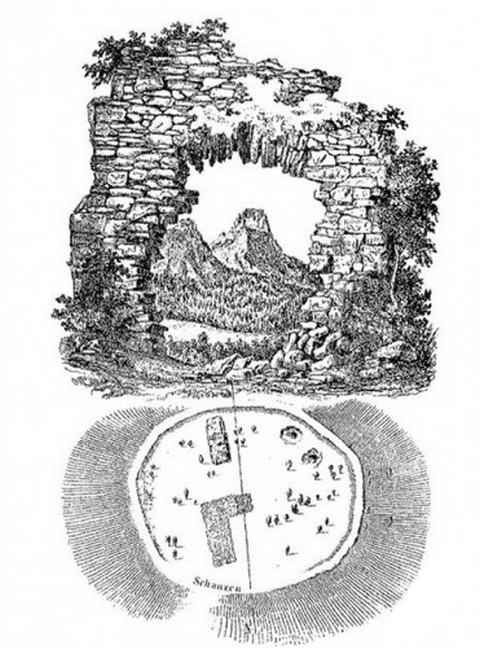
Bermudský štvoruholník v Tríbeči
V tajuplnom pohorí Tríbeč, rozprestierajúcom sa medzi Nitrou, Zlatými Moravcami, Topoľčanmi a Partizánskym, sa záhadne strácajú ľudia už vyše 70 rokov. Zmizli zo zemského povrchu bez stopy, iba po niektorých zostali v tríbečských horách ruiny kamenných domov...
Useful information
The ruin is freely accessible
Zrúcanina je voľne prístupná
Nearby castles
Gýmeš
Jelenec
8.6km
castle ruin
Hrušov
Hostie
9.9km
castle ruin
Skýcov
Skýcov
10.0km
manor, mansion
Klátova Nová Ves
Klátova Nová Ves
10.2km
manor, mansion
Oponice
Oponice
10.4km
castle ruin
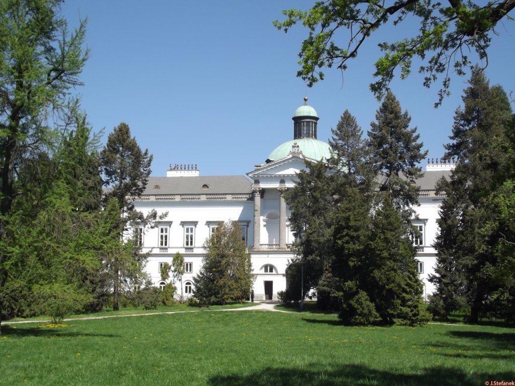
Topoľčianky chateau
Topoľčianky
10.6km
manor, mansion
Oponice - Apponyi mansion
Oponice
10.6km
manor, mansion