Werdenfels Castle
Oberbayern Bayern Germany
castle, chateau
Burg Werdenfels
Oberbayern Bayern Germany
castle, chateau
The ruins of Werdenfels Castle (German: Burg Werdenfels) stand about 80 metres above the Loisach valley between Garmisch and Farchant in the county of Garmisch-Partenkirchen in Upper Bavaria
Die Ruine der Burg Werdenfels liegt etwa 80 Meter über dem Loisachtal zwischen Garmisch und Farchant im Landkreis Garmisch-Partenkirchen in Oberbayern


Previous names
Werdenfels Castle, Burg Werdenfels
Description
The ruins of Werdenfels Castle (German: Burg Werdenfels) stand about 80 metres above the Loisach valley between Garmisch and Farchant in the county of Garmisch-Partenkirchen in Upper Bavaria. The spur castle was used until 1632 as the administrative centre of the County of Werdenfels, but began to fall into disrepair thereafter.
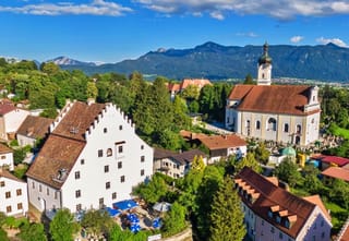
The castle ruins are freely accessible and are a popular hiking destination with a good view of Garmisch-Partenkirchen and the Wetterstein Mountains.
The castle is located at an elevation of 795 m above sea level (NN) northwest of Garmisch-Partenkirchen on an eastern spur of the Kramerspitz in the Ammergau Alps. It stands about 80 metres above the valley floor and is easy to reach on well-signposted paths. The rocky terrain falls steeply from northwest to southeast into the valley, whilst southwest of the castle the land climbs rapidly. This typical castle situation enabled long-distance surveillance of the important trading route in the valley, but it was not possible to protect it directly as the castle was just too far away.
The foundation date of the castle has been hotly disputed in castle research circles. However, it was probably built between 1180 and 1230. Its owner and the purpose of the original fortification are also unknown.
In 1249, ownership of the fortress was transferred to the Prince-Bishopric of Freising and it was occupied with guardians (Burghütern) or governors (Pfleger). In 1294 Count Berthold III of Eschenlohe gave the Bishopric part of his county and was appointed as the castle guardian. After the creation of Freising territory, the County of Werdenfels, the castle served as the administrative and jurdical centre. However, not all governors took up residence in the castle. The county was generally regarded as "the best part of the Imperial Principality of Freising" (Carolus Meichelbeck). It supplied "chamois and red deer venison and game... wood, marble" that could be transported on the rivers Isar and Loisach directly to the cathedral town.
In the 15th century, Freising had to enfeoff the castle several times due to financial difficulties. The structural condition of the castle seems to have deteriorated to the beginning of the 17th century such that the governor's seat was moved in 1632 into a new administrative building on the Wang. From 1676 the fortress was exploited as a quarry. For example, numerous stone blocks from castle were re-used for the new baroque parish churches of Farchant and Garmisch.
As part of the seizure of church land in the Napoleonic era, the castle and county went to the Kingdom of Bavaria. Its population of roughly 5,000 which had hitherto enjoyed imperial immediacy found it difficult at first to get used to their new masters. An 1806 document by a Munich official complains that "many Werdenfelßer still have no Bavarian heart!"
In 1822 the Bavarian privy council, Ignaz von Rudhart, acquired the ruins, since when it has been privately owned.
In 1905-06, the walls were secured and partially rebuilt. After the tops of the walls were secured in 1961/63, further restoration finally began in 1986; this has continued sporadically since.
The construction material for the castle was the local limestone, which was quarried in the Schlosswald ("Castle Wood") above the fortification. Of interest here are the remains of six ring-shaped lime kilns which were archaeologically investigated in 1997.
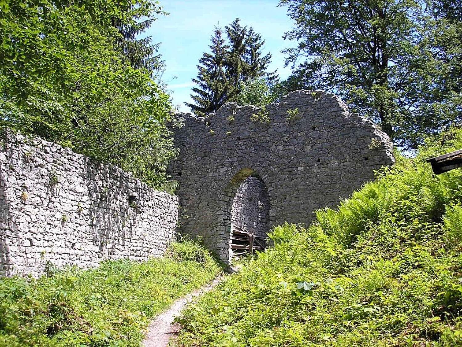
To the south and west a shallow neck ditch guards the position. The approximately square, elevated inner ward (27.6 × 24.8 metres) has two outer wards to the north and west dating to the 14th and 15th centuries.
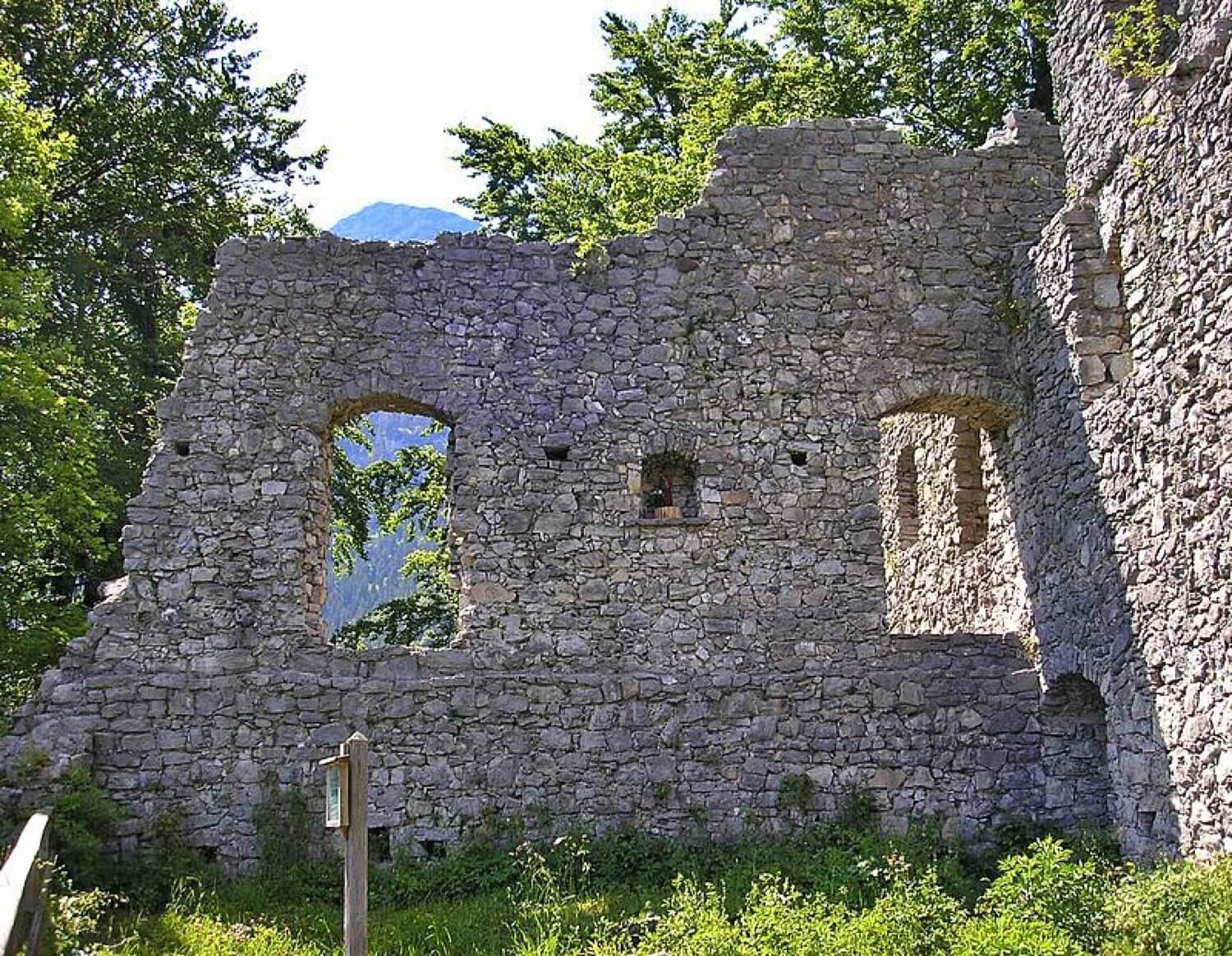
The bergfried rose at or over the northwestern corner of the inner ward, but was completely demolished around 1728/30 leaving a pile of rubble today. The tower was also used in the 15th and 16th centuries as a gaol. Better preserved are the north side and an internal wall of the palas (24.8 × 11.4 metres) and the stonework of the two outer wards with its – largely renovated – 'Mittertor ("Central Gate").
The partially preserved north wall of the palas is pierced on the ground floor by three large pointed arches whose actual function remains a puzzle.
In its last phase of expansion, the castle was probably more of an administrative seat than a fortification and would not have withstood a serious siege for very long. The wall thicknesses only average about 90 centimetres and the main direction of attack was not reinforced or protected by flanking towers. The most defensible part of the castle was the high medieval bergfried of which little is known apart from a few 17th and 18th century illustrations.
Werdenfels Castle's weaknesses as a fortification had been noted by castle researcher, Otto Piper. He recognised that the fortress "so far as the remaining walls are concerned, conspicuously lacks the positions and facilities for a sustained defence“. As a result of his research he finally came to the conclusion that the ruins "no longer correspond to the older castle".
The associated domestic yard lay to the south, below the castle in the valley roughly where the old district office (Amtshaus) is today (Schwaige Wang).
Die Ruine der Burg Werdenfels liegt etwa 80 Meter über dem Loisachtal zwischen Garmisch und Farchant im Landkreis Garmisch-Partenkirchen in Oberbayern. Die Spornburg diente bis 1632 als Verwaltungsmittelpunkt der Grafschaft Werdenfels und begann danach zu zerfallen.
Die frei zugängliche Burgruine bietet als beliebtes Wanderziel eine gute Aussicht auf Garmisch-Partenkirchen und das Wettersteingebirge.
Die Burg befindet sich auf 795 m ü. NN nordwestlich von Garmisch-Partenkirchen auf einem östlichen Ausläufer der Kramerspitz in den Ammergauer Alpen. Sie liegt etwa 80 Meter über den Talboden und lässt sich bequem auf gut beschilderten Wegen erwandern. Von Nordosten bis Südosten fällt das Gelände mit Felsen steil in das Tal ab, während südwestlich der Burg das Gelände rasch ansteigt. Diese typische Burgenlage ermöglichte eine Fernüberwachung der wichtigen Handelsstraße im Tal (Via Imperii), ein direktes Eingreifen war jedoch nicht möglich, da die Burg zu weit entfernt war.
Der Gründungszeitpunkt der Burg wird in der Burgenforschung kontrovers diskutiert. Die Erbauung dürfte jedoch zwischen den Jahren 1180 und 1230 anzusetzen sein. Der Bauherr und die Zweckbestimmung der ursprünglichen Anlage sind ebenfalls unbekannt.
Ab 1249 befand sich die Veste im Besitz des Hochstiftes Freising und wurde mit Burghütern oder Pflegern besetzt. 1294 übergab Graf Berthold III. von Eschenlohe dem Hochstift einen Teil seiner Grafschaft und wurde dafür zum Burghüter bestellt. Nach der Gründung der freisingischen Grafschaft Werdenfels diente die Burg als Pflegamts- und Gerichtssitz. Allerdings nahmen nicht alle Pfleger ihren Wohnsitz auf der Burg. Die Grafschaft galt allgemein als "das beste Stuckh des Reichsfürstenthumbs Freising" (Carolus Meichelbeck). Sie lieferte "Gämbs, rotes und Feder-Wildpräth... Holtz, Marmor", die auf den Flüssen Isar und Loisach direkt bis in die Domstadt transportiert werden konnten.
Im 15. Jahrhundert mussten die Freisinger die Anlage aus Geldnot mehrmals verpfänden. Der bauliche Zustand der Burg scheint sich bis zum Anfang des 17. Jahrhunderts derart verschlechtert zu haben, dass der Pflegsitz 1632 in ein neues Amtshaus auf der „Wang“ verlegt wurde. Ab 1676 beutete man die Veste als Steinbruch aus. So wurden etwa zahlreiche Burgsteine beim Neubau der barocken Pfarrkirchen von Farchant und Garmisch wiederverwendet.
Im Zuge der Säkularisation kamen Burg und Grafschaft an das Königreich Bayern. Die etwa 5000 Bewohner der ehemals reichsunmittelbaren Herrschaft konnten sich anfangs nur schwer an ihre neuen Herren gewöhnen. Aus dem Jahr 1806 ist die Klage eines Münchner Beamten überliefert. dass "viele Werdenfelßer noch keine Bairischen Herzen haben!"
1822 erwarb der bayerische Staatsrat Ignaz von Rudhart die Ruine, die sich seitdem in Privatbesitz befindet.
1905/06 wurden die Mauern gesichert und teilweise rekonstruiert. Nach einer Mauerkronensicherung in den Jahren 1961/63 begannen schließlich 1986 weitere Sanierungsmaßnahmen, die seitdem in kleineren Abschnitten weitergeführt werden.
Als Baumaterial für die Burg diente der anstehende Kalkstein, den man im „Schlosswald“ oberhalb der Veste brach. Bemerkenswert sind dort auch die Überreste von sechs ringförmigen Kalkbrennereien, die 1997 archäologisch untersucht werden konnten.
Im Süden und Westen schützt ein flacher Halsgraben die Anlage. Der annähernd quadratischen, erhöht liegenden Kernburg (27,6 × 24,8 Meter) sind nördlich und westlich zwei Vorburgen des 14. und 15. Jahrhunderts vorgelagert.
Der Bergfried erhob sich am oder über dem Nordwesteck der Hauptburg, ist aber heute auf einen Schutthügel vollständig abgegangen (Abbruch 1728/30). Der Turm diente im 15./16. Jahrhundert auch als Gefängnis. Besser erhalten haben sich die Nord- und eine Zwischenwand des Palas (24,8 × 11,4 Meter, alle Maßangaben nach Zeune) und das Mauerwerk der beiden Vorburgen mit dem – stark erneuerten – „Mittertor“.
Die teilweise erhaltene Nordwand des Palas wird im Erdgeschoss von drei großen Spitzbogenöffnungen unterbrochen, deren eigentliche Funktion bis heute Rätsel aufgibt.
Die Burg war in ihrer letzten Ausbaustufe wohl eher Verwaltungssitz als Wehrbau und hätte einer ernsthaften Belagerung nicht lange widerstanden. Die Mauerstärken betragen durchschnittlich nur etwa 90 Zentimeter, die Angriffsseite wurde nicht verstärkt oder durch Flankierungstürme geschützt. Der wehrhafteste Bauteil war der hochmittelalterliche Bergfried, der allerdings nur durch einige Ansichten aus dem 17. und 18. Jahrhundert überliefert ist.
Die fehlende Wehrhaftigkeit der Burg Werdenfels bemerkte bereits der Burgenforscher Otto Piper. Er erkannte, dass die Veste „soweit das Mauerwerk noch vorhanden ist, in auffallender Weise Anlagen und Vorkehrungen zu nachhaltiger Verteidigung vermissen lässt“. Er kam bei seinen Untersuchungen schließlich zu dem richtigen Schluss, dass die Ruine „nicht mehr der älteren Burganlage entspricht“.
Der zugehörige Wirtschaftshof lag südlich unterhalb im Tal an Stelle des noch heute erhaltenen Amtshauses (Schwaige Wang).
Nearby castles