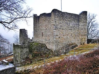
Alte Burg (Pappenheim)
Mittelfranken Bayern Germany
castle, chateau
Alte Burg (Pappenheim)
Mittelfranken Bayern Germany
castle, chateau
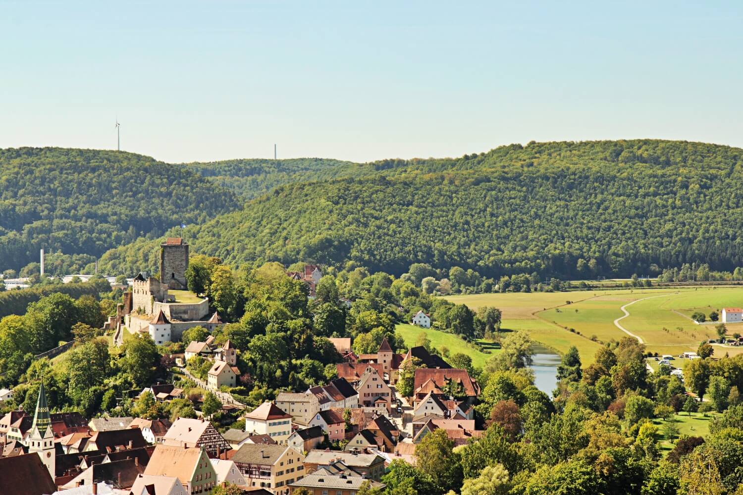
The Pappenheim Castle is the ruin of a Spur castle on a long mountain ridge in a Altmühl loop over the homonymous city Pappenheim in the district of Weissenburg-Gunzenhausen in Central Franconia
Die Alte Bürg ist eine abgegangene frühmittelalterliche Spornburg auf einem Bergsporn westlich über der Stadt Pappenheim im Landkreis Weißenburg-Gunzenhausen in Bayern
Previous names
Alte Burg (Pappenheim), Alte Burg (Pappenheim)
Description
The Pappenheim Castle is the ruin of a Spur castle on a long mountain ridge in a Altmühl loop over the homonymous city Pappenheim in the district of Weissenburg-Gunzenhausen in Central Franconia . The headquarters of the powerful Reich ministerials and later Counts of Pappenheim is considered one of the most important medieval castle ruins in Bavaria. An older castle stable is located a few hundred meters west-southwest of the ruin on a wooded hill ( Alte Bürg ).
HIstory
A small castle complex may have stood on the area of the outer bailey in the early High Middle Ages . This residence is said to have been restored around 1030 after being destroyed. However, some researchers doubt the existence of this predecessor system ( Daniel Burger ). The tradition of such a predecessor castle cited in the older literature goes back to the Augsburg canon Matthäus von Pappenheim-Biberbach (1458–1541) and has not yet been confirmed by excavations or readings. In terms of defense technology, this castle would actually have been rather unfavorable. It is possible that an older castle seat was on the "Alten Bürg", an originally early one Fortification, which verifiably continued to be used until the High Middle Ages.
The partially preserved castle complex was probably founded around 1140 by the Reichsministeriale von Pappenheim, who later held the office of Reichsmarschalls. The oldest parts of the castle (archaeological studies are missing so far) are in the area of the core castle. The castle chapel above the gate dates from the late 12th century. The later Pappenheimers already served the Salians as servants. The first tangible ancestor of the family is Heinrich Caput (head), an important and valued ministerial of Heinrich V. In the following generation, the family began to split into several branches.
The castle first appears in a written source around 1214 as the property of the Imperial Hereditary Marshals. The chapel was consecrated between 1171 and 1182 by the Eichstatt Bishop Egelolf .
The appointment of the Reichsministeriale von Pappenheim certainly served to secure the domestic power of Staufer Konrad III. In the region around Nuremberg , Weißenburg and Rothenburg the king pursued an intensive imperial and domestic power policy as part of the overall concept of a "Terra Imperii". Pappenheim was in the border area between Franconia , Bavaria and Swabia . The new castle was certainly also a reaction to the simmering conflict between the Hohenstaufen and the southern German Welfs , who did not want to stand idly by the loss of Bavaria and Saxony. So did HerzogHenry the Proud refuses to pay homage to the king.
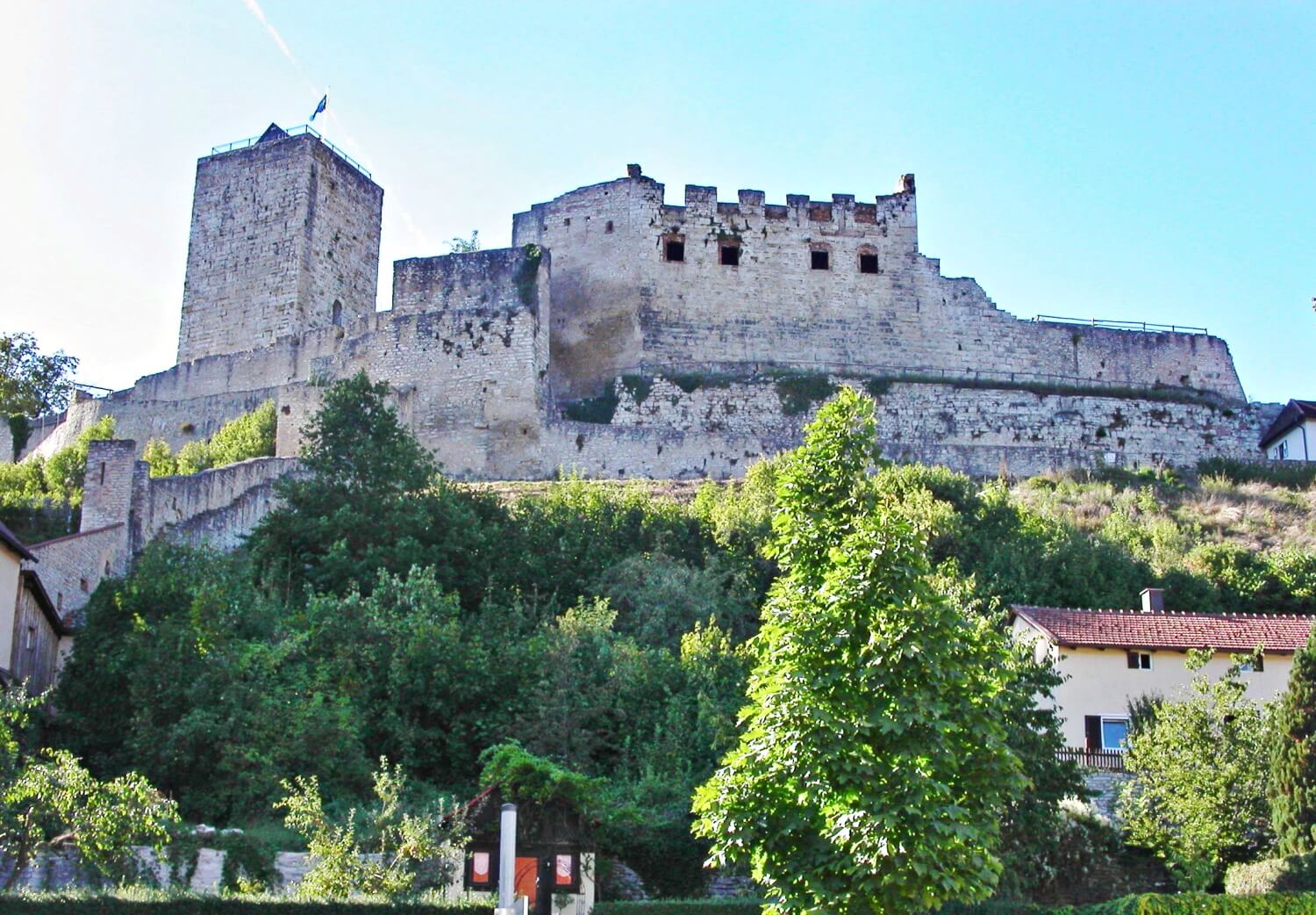
In the early 13th century, the castle was massively expanded, recognizable by the large-format humpback blocks on the circular wall (remains), residential buildings and keep . Around 1220 the Bavarian Duke Otto the Illustrious besieged the fortress and caused some damage. The duke supported the anti -king Heinrich Raspe IV against the emperor and his partisans. Reconstruction began in 1221. In 1264 repairs had to be carried out again after repeated war damage.
At the end of the 13th century, the brothers Hiltprand and Heinrich divided the family property between themselves. Heinrich von Pappenheim began expanding the castle in 1280. At that time, the outer bailey in particular was expanded on the endangered west side.
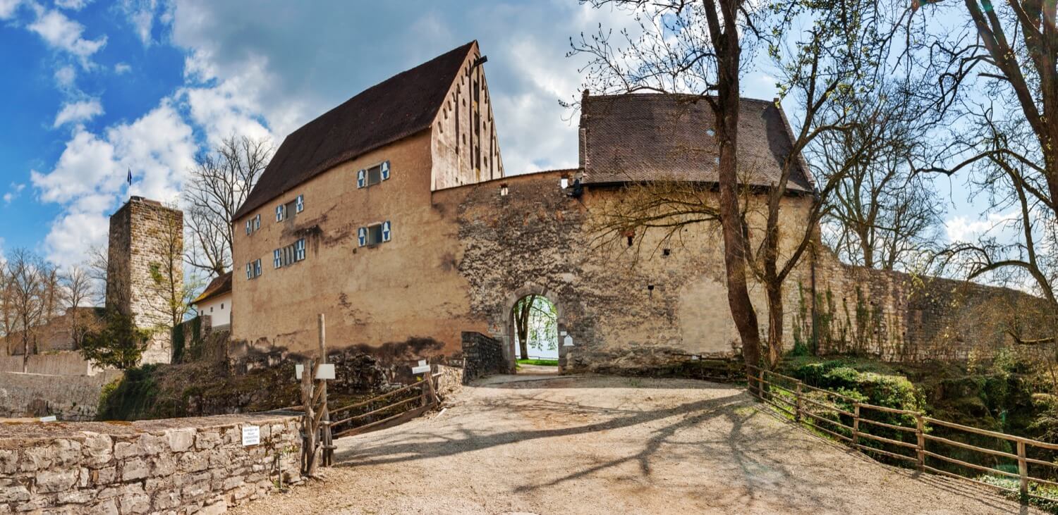
In the following centuries the facility was rebuilt and modernized several times. There are a number of spoils of late Gothic extensions to the main castle, and two buildings from the late 15th century are still under roof in the outer castle. Around 1500 the main castle was surrounded by a kennel with round towers on the city side.
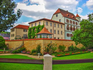
In 1593 the ruling senior of the family left the Höhenburg and moved into his new city palace in the valley. The castle, however, remained inhabited and was reinforced with military technology, especially at the time of the Thirty Years War , in order to withstand the attacks of the Protestant troops. Around 1632 they even planned a fortress-like expansion of the main castle. A modern bastionary fortification would have been built in place of the late medieval double kennels. During the fighting, the castle changed hands several times. The preserved, unexecuted expansion plan seems to have been made by a Swedish builder. The bombardment of the facility by the troops of the Protestant field marshalHorn (1633) may have caused considerable damage. In any case, the north-western hall building only appears as a ruin on a view from 1664.
The spur castle stands on a north-east facing mountain spur around which the Altmühl flows . The two-part complex is one of the largest aristocratic castles in Franconia (total length around 280 meters) and documents the prominent position of the Pappenheimers as hereditary marshals of the empire.
Vorburg
The ridge southwest of the main castle is built over by an extensive outer castle . A predecessor castle "Kaltenegg" was possibly located here as the oldest residence of the Pappenheimers, who originally called themselves "von Kalden" or "Caletin".
The angled neck ditch of the outer bailey was blasted out of the rock and is about 15 meters deep. The high ring wall is reinforced by two massive shell towers. The wall was originally higher, with two battlements on the inside . The gate is to the north and is flanked by two tall 15th century buildings. In the “Preißinger (in) haus” in the east there are three hall-like rooms on the floors, which are supported by a strong beam construction.
Both buildings show late Gothic architectural decorations. The "donkey stable" wearing pointed arch panels and fialenartige essays, the "Preisinger (in) home" pointed arch friezes and Wandlisenen .
A brick bridge provides access to the main castle. Originally a wooden footbridge and a drawbridge spanned the moat.
Main castle
The main castle in the northeast is separated from the outer castle by a deep ditch. On the other sides, the mountain slopes drop relatively steeply and thus offered natural protection. The entrance to the main castle was protected by the unusually powerful keep, which was the only building that survived the multiple destruction of the fortress more or less unscathed. A kennel like Torgasse leads from the outer gate of the main castle for passage into the inner court. The remains of the Romanesque castle chapel St. Georg (formerly St. Blasius) have been preserved above this inner gate . A semicircular apse in the outer wall refers to its former function as a sacred space . The two-part storey below ( common vault) seems to have served as a fire-proof room for storing certificates and documents.
The remains of the palace can be seen to the northeast . Old views of the castle show four floors, only sparse wall remnants of the windowless ground floor have been preserved facing the castle courtyard. In the Middle Ages, the utility rooms were located here, above a large hall which was spanned by a wooden ceiling.
The other buildings are grouped around a narrow atrium, but are almost completely gone. Here stood a bower , the wing known as the Hohe Lauben , and an additional residential building. At times four branches of the Pappenheim family lived in the castle,
Under the almost rectangular ring of the main castle are mighty late medieval kennels, which are reinforced in the northeast by two round towers. The spacious outer kennel is protected in the northeast by the "Affenstein". The small round tower, like the two artillery towers above, was changed in modern times by adding apartments.
Fountain
At the end of the gate kennel of the main castle, to the right of the gate, is the fountain house jutting out into the kennel. The castle well is said to have reached the groundwater level (around 75 meters). The well shaft was driven into the upcoming Jurassic limestone rock. A wooden treadmill made it possible to transport drinking and industrial water. The massive expansion of the well room goes back to the time of the Thirty Years' War. During a siege , the well room was destroyed by an artillery hit, which is said to have led to the abandonment of the castle.
https://second.wiki
Die Alte Bürg ist eine abgegangene frühmittelalterliche Spornburg auf einem Bergsporn westlich über der Stadt Pappenheim im Landkreis Weißenburg-Gunzenhausen in Bayern.
Bei der Burg handelt sich um eine stark bewehrte Abschnittsbefestigung aus dem 7. oder 8. Jahrhundert, geschützt von einem doppelten äußeren Abschnittswall mit vorgelagertem Graben, dessen Höhe vom Graben aus heute noch 1,7 Meter beträgt, sowie einem inneren Abschnittswall mit Graben, was von mehreren Befestigungsphasen zeugt. Von der Alten Bürg stammen auch Funde der frühen Bronze- und der Hallstattzeit sowie zwei Fragmente karolingisch-ottonischer Keramik. Heute ist die Burgstelle ein Bodendenkmal.
Vermutlich war die Alte Bürg eine Vorgängeranlage der späteren auf dem unteren Felsen gelegenen Burg Pappenheim.
Beschreibung
Die Abschnittsbefestigung liegt auf einem nach Osten vorspringenden Bergsporn, der nach Norden, Osten und Süden steil in die umgebenden Täler abfällt. Geschützt wird die Anlage durch drei Wallgräben, die sich über das etwa 50 bis 60 Meter breite Bergplateau ziehen, und die sich teilweise auch den Hang hinunter erstrecken.
Der äußere Abschnittswall befindet sich in einem Abstand von etwa 320 Meter zur Spitze des Bergspornes, im Norden erstreckt er sich bis zum Plateaurand und führt noch einige Meter den steilen Hang hinunter. Der Wall zieht sich geradlinig vom nördlichen Berghang aus nach Süden, knickt dann nach 80 Meter in südsüdöstlicher Richtung um und verläuft in diese Richtung noch weitere 40 Meter. Auch an dieser Seite läuft der Wallgraben den Steilhang noch einige Meter hinab. An diesem Ende des Walls wird auch der ursprüngliche Zugang vermutet. Dieser Wallgraben besteht aus zwei nah aneinandergesetzten Wällen, die von einem vorgelegten Graben begleitet werden. Der innere dieser beiden Wälle ist an seiner Basis noch etwa 7 Meter breit und vom Graben aus 2,5 Meter hoch, der äußere ist noch etwa 4 Meter breit und 0,5, vom Graben aus noch 1,3 Meter hoch erhalten.
Etwa 150 Meter nach dem äußeren Wall überquert das Bergplateau ein teilweise aus dem Fels gehauener Graben mit einem schwach erhaltenen Wall an seiner Innenseite. Der Graben ist vier Meter breit und maximal einen Meter tief. Auch dieser Graben erstreckt sich von Nord nach Süd und biegt dann nach Südsüdosten um.
Weitere 20 bis 30 Meter nach diesem Graben, etwa 150 Meter vor dem Spornende, quert ein innerer, steinerner Wall, dem teilweise ein Graben mit Außenwall vorgelagert ist, das Plateau. Dieser Wall zieht sich 60 Meter von Nordnordwesten nach Südsüdosten, und biegt dann nach Osten um, wo er den Plateaurand noch 60 Meter lang begleitet. Der Graben mit dem Außenwall befindet sich an der Westseite, gegen das anschließende Bergplateau. Dieser Wall ist an seiner Basis noch 8 Meter breit und von der Sohle des Grabens aus noch 2,5 Meter hoch. Der Zugang zu diesem inneren Bereich der Anlage ist im Norden anzunehmen, da hier der Wall leicht nach innen umbiegt.
Useful information
Nein
Gratis
Ruinen der Burg
-
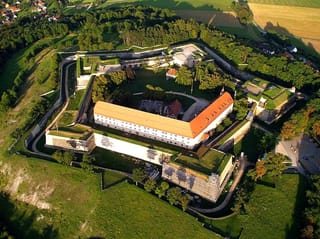
Nearby castles
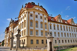
Stadtschloss Treuchtlingen
Mittelfranken
5.1km
castle, chateau
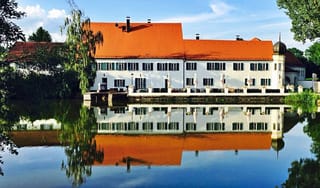
Burg Treuchtlingen
Mittelfranken
5.7km
castle, chateau
Wülzburg
Mittelfranken
10.6km
castle, chateau
Schloss Tagmersheim
Schwaben
12.4km
castle, chateau
Schloss Monheim
Schwaben
13.0km
castle, chateau
Ellingen Residence
Mittelfranken
14.2km
castle, chateau
Schloss Otting
Schwaben
14.5km
castle, chateau