Fort of São João Baptista of Praia Formosa
Almagreira Azores Portugal
fortress
Forte de São João Baptista da Praia Formosa
Almagreira Azores Portugal
fortress
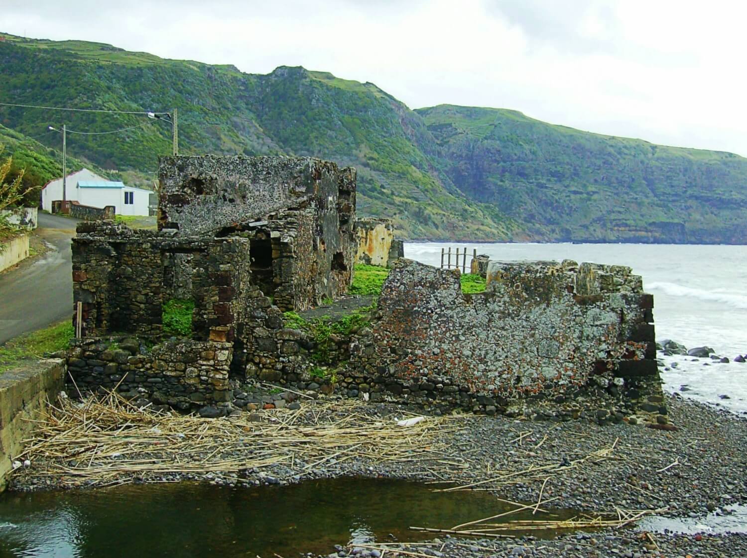
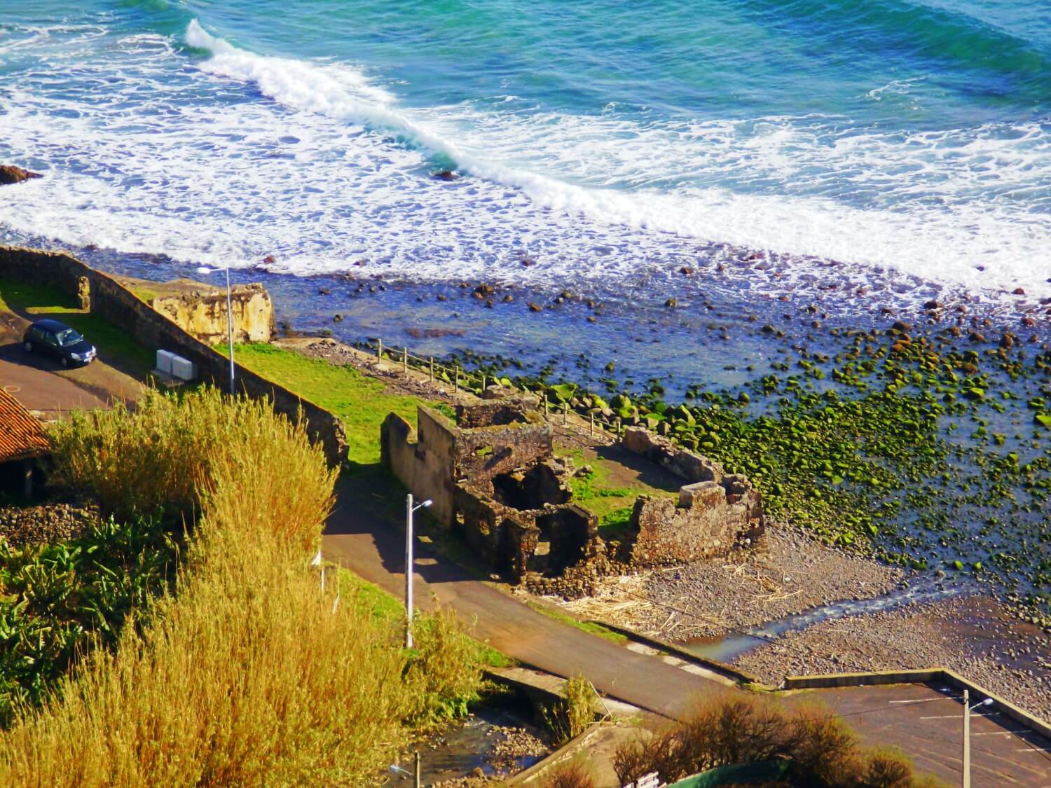
The Fort of São João Baptista (Portuguese: Forte de São João Baptista/Castelo da Praia) is the ruins of a 16th-century maritime fort situated on the western edge of Praia Formoso, in the civil parish of Almagreira, municipality of Vila do Porto, on the Portuguese island of Santa Maria (in the archipelago of the Azores)
O Forte de São João Baptista da Praia Formosa, também denominado como Castelo de São João Baptista ou Castelo da Praia, localiza-se na praia Formosa, na freguesia da Almagreira, concelho da Vila do Porto, a SSO na ilha de Santa Maria, nos Açores
Previous names
Fort of São João Baptista of Praia Formosa, Forte de São João Baptista da Praia Formosa
Description
The Fort of São João Baptista (Portuguese: Forte de São João Baptista/Castelo da Praia) is the ruins of a 16th-century maritime fort situated on the western edge of Praia Formoso, in the civil parish of Almagreira, municipality of Vila do Porto, on the Portuguese island of Santa Maria (in the archipelago of the Azores).
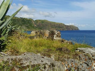
Located in a strategic point along the southern coast, the fort was constructed to defend the anchorage from attacks by pirates and corsairs, that frequented this region of the Atlantic during the Age of Discovery. Contemporary archaeological campaigns during the 20th century attempted to ascertain if this forte constituted one of the oldest in the archipelago, yet this never conclusively validated by documented sources. In fact, the oldest forts in the Azores have been validated in Terceira and São Miguel: Castle of São Cristóvão (1460), in the Alto dos Moinhos, Angra do Heroísmo; the Fort of São Brás (1551) in Ponta Delgada; and the Fort of São Sebastião (1572) over the Porto das Pipas, also in Angra dor Heroísmo.
History
The beach on which the fort was raised was, in 1584, referred to as Plaia Hermosa, based on the Castillian language, owing to Spanish dominion of the region at the time. The same author (Luís Teixeira), later (1587) indicated that this region served within the religious parish of Figueira (Portuguese: Paróquia da Figueira) which, before its construction, included little more than 40 people, in an area called Praia Fremosa.
English privateers (1599) and, later, Algerian Barbary coast pirates (June 1616) used this beachhead in their assaults on the island, the latter resulting in major damage to Vila do Porto.
Apparently, the initial requests were not taken seriously, and the 1616 incursion resulted in the cataclysmic destruction of Vila do Porto. In 1617, a new request was made directly to Philip III of Spain, by the third Donatary-Captain, Pedro Soares de Sousa. The memory of the 1616 catastrophe and these recommendations to the monarch, resulted in initial steps in 1618 to defend "the women and children and herds". The author of the building's construction is unknown, although it is speculated that Sergeant-major Marco de Teive, who visited the archipelago in 1630, may have had a hand in its construction, during his visit to Santa Maria. It is known that following the 1616 tragedy, in 1617 (by royal order) Captain Marcos Fernandes de Teive was sent to the islands to design and initiate construction of new battlements, in addition to reorganizing the militia.
Yet, the work on the fortifications did not progress. In 1624, in order to speed up construction, Philip IV of Spain granted Brás Soares de Sousa (in compensation for his services in North Africa), the Command of the island of Santa Maria (through the Order of Jesus Christ), with the right to his privileges as of 24 June 1623. But, many of the resources were used in Royal Service, and the monarch imposed on Brás Soares de Sousa the obligation to donate, for five years, the land rents of the command towards the fortifications necessary for the island. These lands rents would be safeguarded in a separate coffer and only spent on the construction, by order of the Finance Council. Only after the completion of the public works, would those monies would be once again used for the repairs of churches as needed, as stipulated by Council for Religious Conscience and Orders.
Two decades later (1638) the town hall registered: "A fortification on this island, that was started, but not finished." By the Restoration Wars (1640-1668), due to the difficult circumstances of the civil authorities in Vila do Porto, the Crown provided monetary funds for the defence of Praia Formosa. But, even by 1664, the issue of artillery at the site had not been resolved, even as the King had ordered their installation in 1655. By Royal decree, on 6 August 1683, Vicente Pires Ferreira was placed in the position of constable for castles and redoubts, following the death of his father, overseeing the beach of São João and its fortifications.
The "Relação" by field marshall Baron of Bastos, in 1862, informed the Crown, that the castle : "has a high barracks and a kitchen" and that it was in a state of ruin.
By the end of the 20th century, there still existed two artillery pieces on the abandoned battlements, alongside the ruin structure (which since disappeared). A later periodical indicated: "The Câmara Municipal de Vila do Porto will proceed with the removal of the two, old pieces that exist in the abandoned small castle of Praia. Once they are recuperated, this pieces will be ceded to the Museum of Santo Espírito to be publicly exhibited." Yet, there are no proofs that the pieces finally made it to the museum. In fact, there is speculation that any of those artillery-pieces may have joined the group in the Fort of São Brás in Vila do Porto.
Ferreira (1997) registered the state of ruin of the fort, of what he defined as a 16th-century fort. Technical studies were made at the site, in order to recuperate the structure, by then in an advance stage of degradation and which was not registered for protection or classification.
The grounds of the fort were used as a secondary stage (Palco Oportunidades - DRJ), during the 23rd Annual Festival Maré de Agosto in 2007.
Between 27–28 September 2011, a storm with winds exceeding 85 kilometres per hour (53 mph), heavy rainfall and waves affected the southern coast of the island), resulting in landslides that influenced the ruined structure, alongside the ravine. Consequently, the remaining portions of the structure continued to deteriorate.
O Forte de São João Baptista da Praia Formosa, também denominado como Castelo de São João Baptista ou Castelo da Praia, localiza-se na praia Formosa, na freguesia da Almagreira, concelho da Vila do Porto, a SSO na ilha de Santa Maria, nos Açores.
Em posição estratégica sobre este trecho da costa da ilha, constituiu-se em um forte destinado à defesa deste ancoradouro contra os ataques de piratas e corsários, outrora frequentes nesta região do oceano Atlântico.
As recentes campanhas de prospecção arqueológica nele desenvolvidas levantam a possibilidade de constituir-se na mais antiga estrutura de fortificação no arquipélago.
História
A praia onde se localiza encontra-se referida no mapa dos Açores, de autoria de Luís Teixeira, datado de 1584, com o nome de "Plaia Hermosa"
O Alvará Real de 6 de agosto de 1683 nomeou Vicente Pires Ferreira, por falecimento de seu pai, Rodrigo Gonçalves Ferreira, como condestável do Castelo e Redutos do lugar da praia de São João da ilha de Santa Maria, vencendo o mesmo soldo.
No contexto da Guerra da Sucessão Espanhola (1702-1714) encontra-se referido como "O Forte (...) , da Praya, e os dous Redutos." na relação "Fortificações nos Açores existentes em 1710".
A "Relação" do marechal de campo Barão de Bastos em 1862 informa que "Tem um quartel alto e uma cozinha" e que se encontra arruinado.
Em fins do século XX ainda se viam duas das antigas peças de artilharia abandonadas por terra junto à estrutura em ruínas, hoje desaparecidas.
FERREIRA (1997) regista-lhe o estado de ruína, remontando-o ao século XVI.
Existe estudo detalhado para a consolidação e recuperação do conjunto que, em ruínas, não se encontra classificado ou protegido.
O espaço do antigo forte foi utilizado como segundo palco (Palco Oportunidades - DRJ) na 23ª edição do Festival Maré de Agosto em 2007.
O mau tempo que atingiu as ilhas do Grupo Oriental entre 27 e 28 de setembro de 2011, com ventos de até 85 km/h, forte precipitação de chuvas e grandes ondulações, levou à derrocada de parte da antiga estrutura, no lado voltado para a ribeira.
Desconhece-se localmente quem possa ser o responsável pelo imóvel para fins de conservação, razão pela qual o mesmo se encontra em estado de abandono. Entretanto, o mesmo encontra-se em área de Domínio Público Marítimo, sendo, em termos de Direito, propriedade inalienável do Estado Português. historicamente, a jurisdição desta faixa estava sob a alçada da Marinha Portuguesa, tendo passado para a (hoje extinta) Direcção Geral de Portos. Em 1992 essas competências foram, na sua maior parte, transferidas para o Ministério do Ambiente.
Em termos da Região Autónoma dos Açores, as linhas de orientação relativas a intervenções no litoral estão consagradas na Resolução nº 138/2000, de 17 de Agosto. No tocante à ilha de Santa Maria, cujo Plano de Ordenamento da Orla Costeira (POOC) foi aprovado pelo Decreto Regulamentar Regional nº 15/2008/A, de 25 de junho, como às demais ilhas, cabe à Direcção Regional de Ordenamento do Território e Recursos Hídricos a atribuição de emissão dos pareceres que servem, posteriormente, às Câmaras Municipais para fins de emissão (ou não) de licenças de construção.
Useful information
Free
Free
Great view
Ruins of the fort
-
Nearby castles