Nová Baňa
Nová Baňa Banská Bystrica county Slovakia
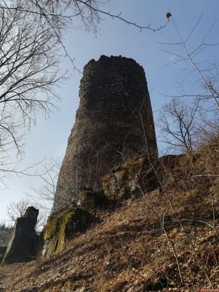
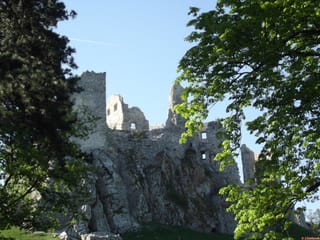
castle ruin
Nová Baňa
Nová Baňa Banskobystrický kraj Slovakia
zrúcanina hradu
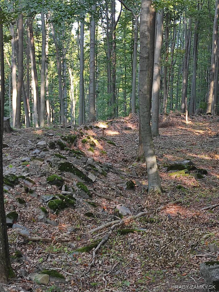
Archaeological site, remains of walls and ramparts of the fortified settlement, about 10 km west of Nová Baňa above the settlement of Stará Huta and Bukovina, on a steep hill below the highest peak of the Pohronský Inovec mountain range - Veľký Inovec
Archeologická lokalita, zvyšky múrov a zachované valy opevneného hradiska, asi 10 km západne od Novej Bane nad osadou Stará Huta a Bukovina, na strmom kopci pod najvyšším končiarom pohoria Pohronského Inovca – Veľkým Inovcom
Previous names
Seunich, Königsberg, Újbánya
Roads
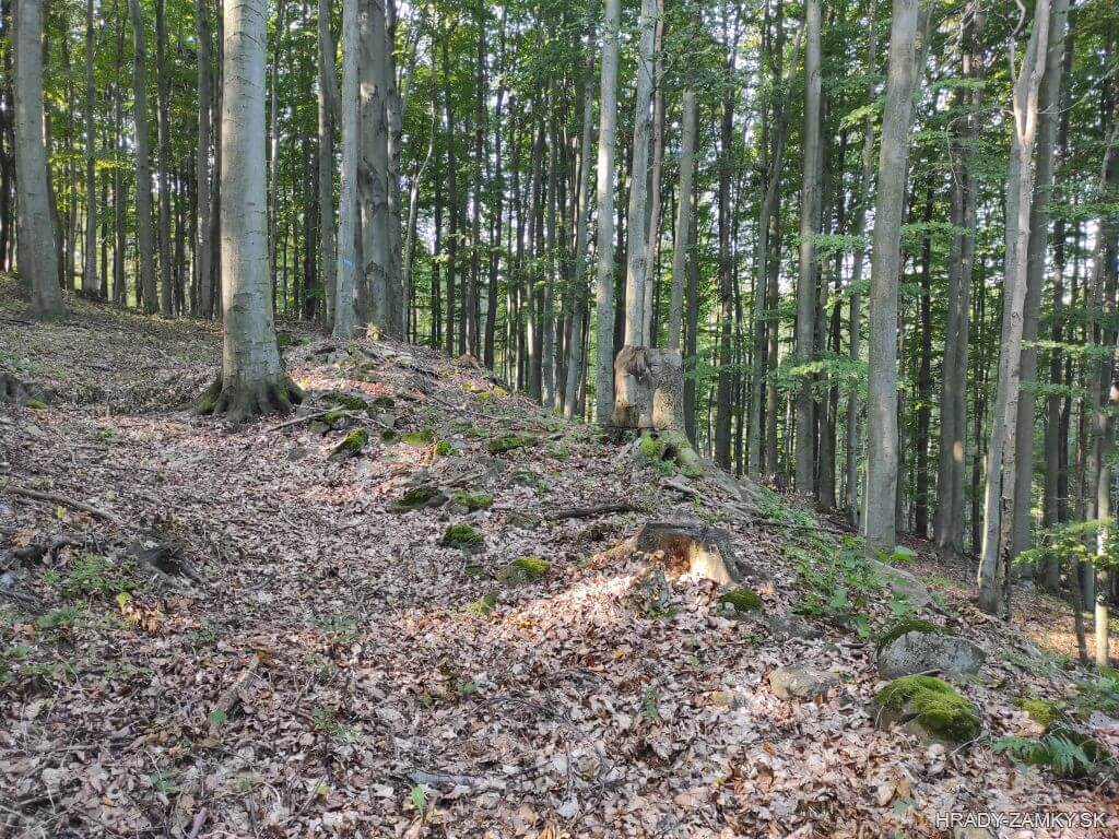
From Nová Baňa we get to the village of Stará Huta. We pass through the village and about 1 km we come to an inconspicuous turn to the left, just behind the Drozdovo bus stop. We continue a few meters along a broken road to the reservoir, where the road branches off. We can park here. From the water reservoir we continue on the way to the left - along the green route, which leads to Veľký Inovec. The ascent can be a bit demanding, but after about 500 m we intuitively turn left from this route, where you can see a quasi-open entrance to the forest. Climbing we continue on an unmarked path to the top of the hill, where we come across massive ramparts. We continue through the forest further to the right along the top, at the edge of the position we will see interesting rock formations and even further the remains of walls with the square floor plan.
Z Novej Bane sa dostaneme do obce Stará Huta. Prejdeme obcou a zhruba o 1 km prídeme k nenápadnej odbočke vľavo, hneď za autobusovou zastávkou Drozdovo. Pokračujeme pár metrov po síce rozbitej, ale schodnej ceste až k vodnej nádrži, kde sa cesta rozvetvuje. Tu môžeme zaparkovať. Od vodnej nádrže pokračujeme cestou vľavo - po zelenej trase, ktorá vedie až na Veľký Inovec. Stúpanie trochu dá zabrať, no po asi 500 m intuitívne odbočíme z tejto trasy doľava, kde je vidieť kvázi otvorený vstup do lesa. Stúpaním pokračujeme neznačenou cestou až na vrchol kopca, kde natrafíme na mohutné valy. Pokračujeme lesom ďalej vpravo po vrchole, na okraji polohy uvidíme zaujímavé skalné útvary a ešte ďalej zvyšky múrov v pôdoryse štvorca.
Description
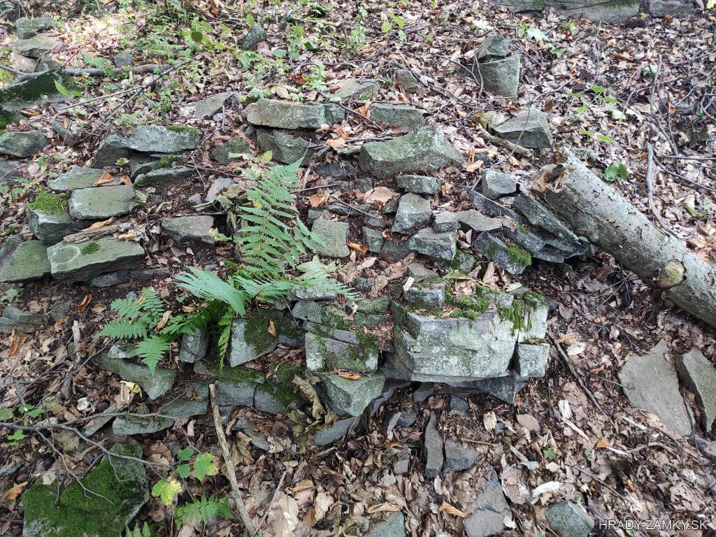
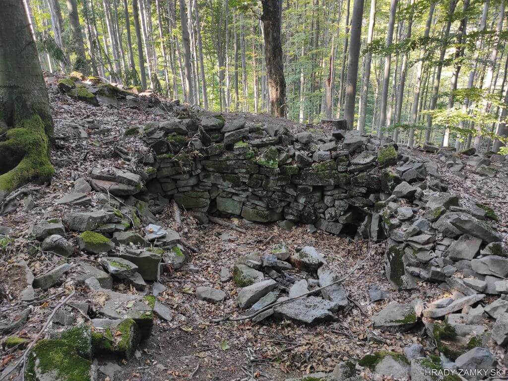
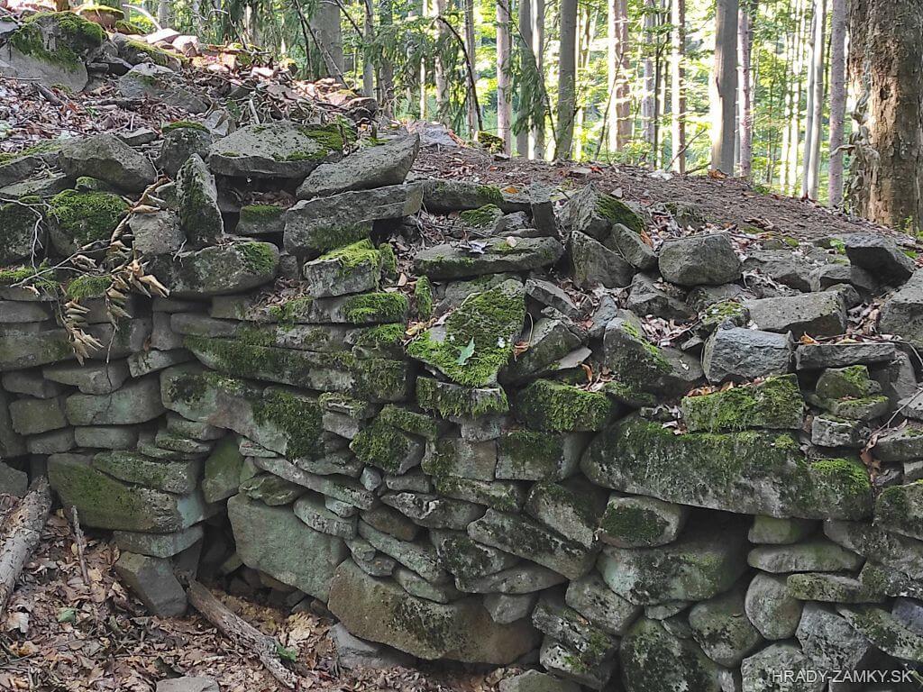
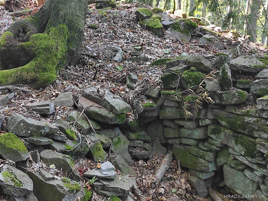
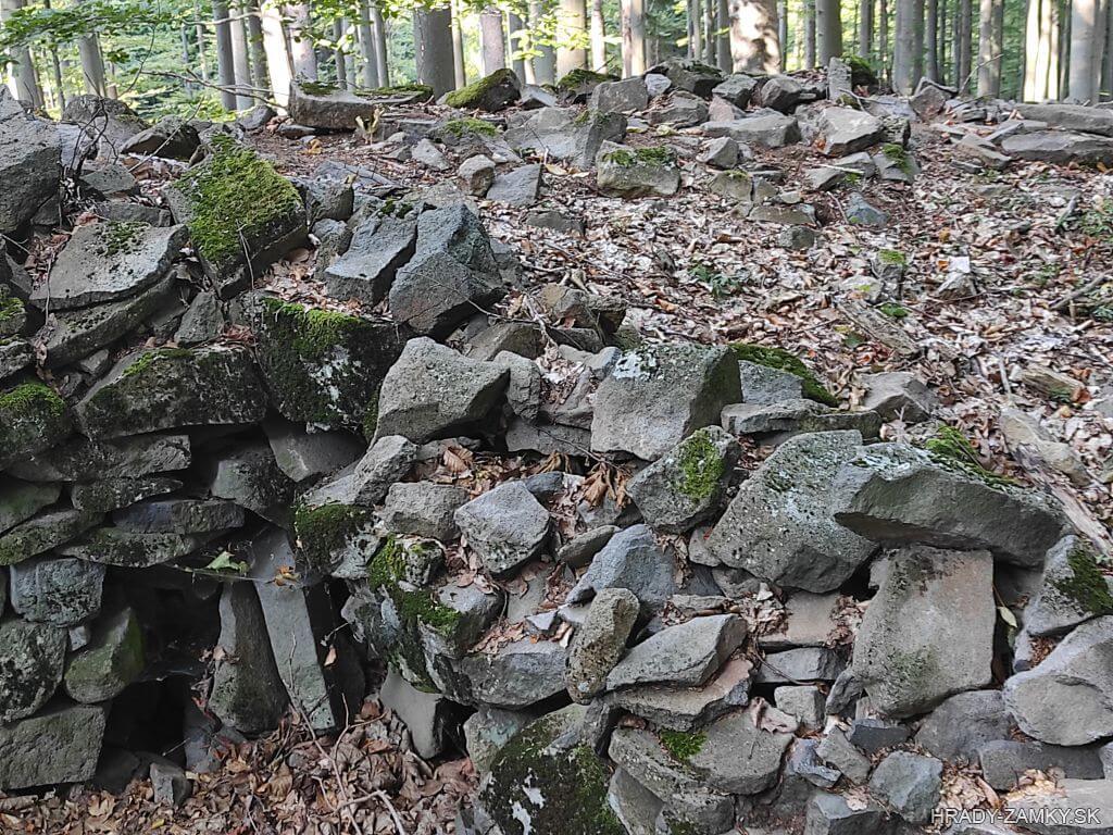
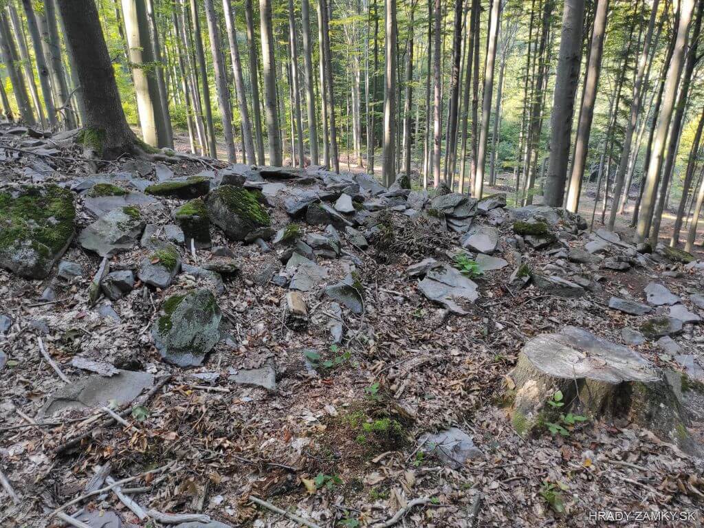
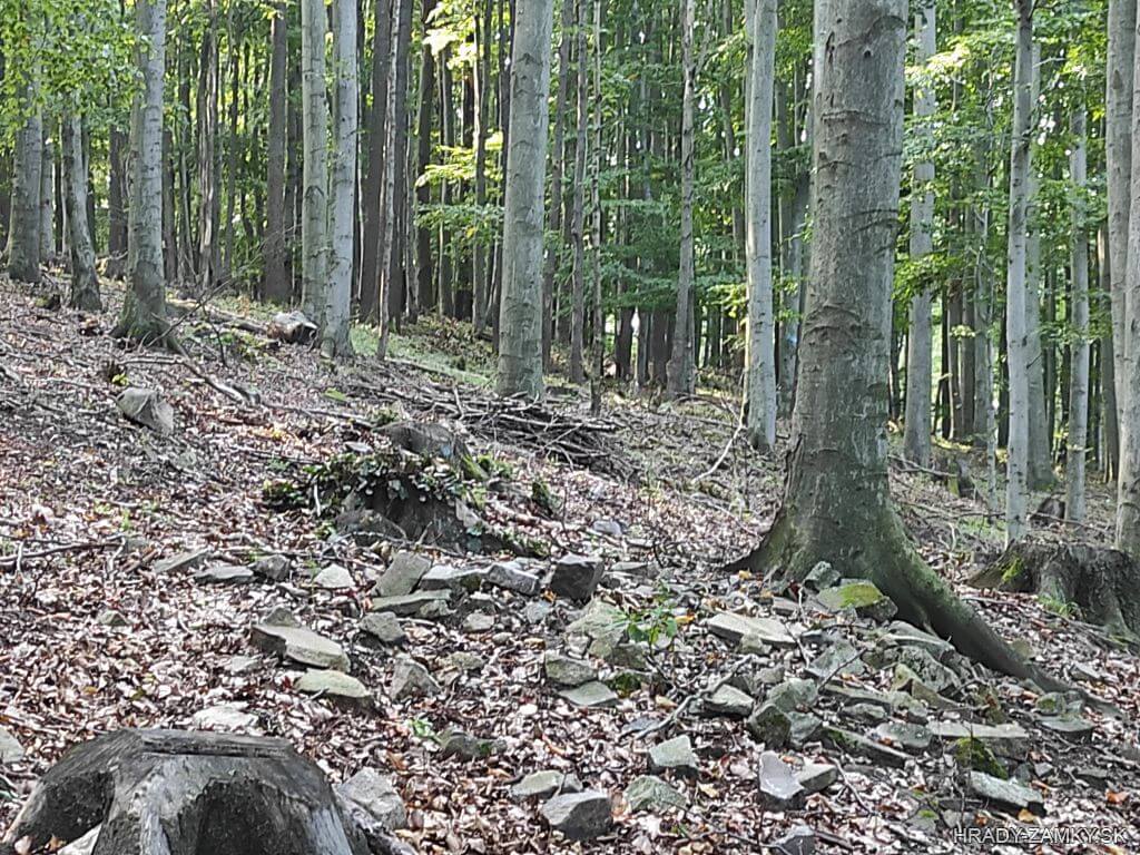
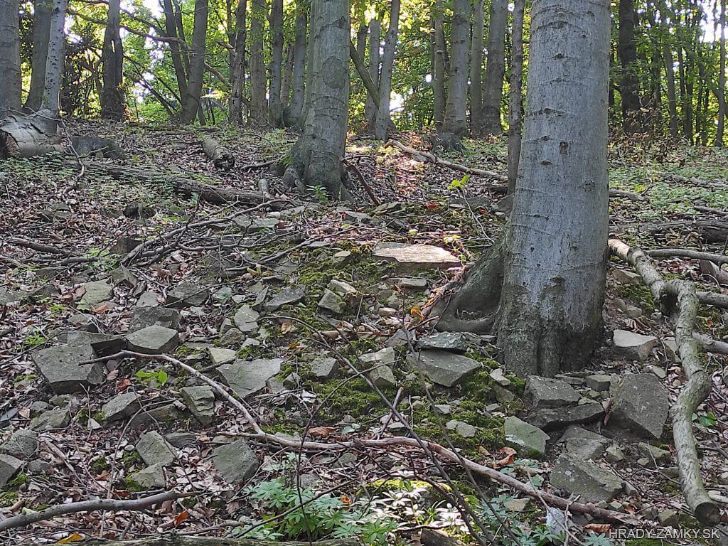
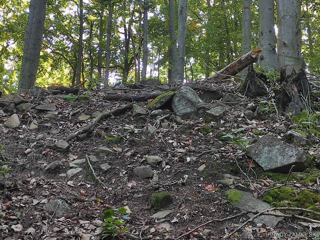
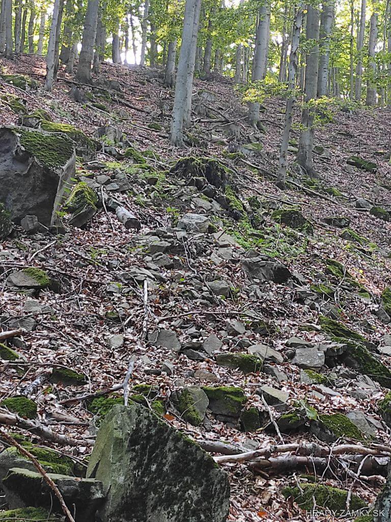
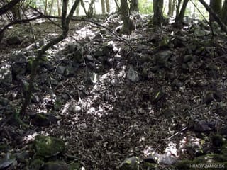
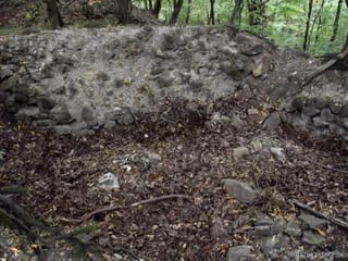
The earth wall of the fortified settlement with a length of 430 m was reinforced on the inside with a solid stone wreath. This testifies to the massive fortification system, which was formed on the north side by a favorable terrain configuration. The rampart passes in places on larger sections into the stone structure and protected the entire area, which covered an area of about 7 hectares. The area was divided into two unequal parts by a longitudinal andesitic rock formation in the north-south direction.In the western part of the fort, the remains of 40-45 cm thick and 110 cm high walls of an almost square floor plan with dimensions of 250 X 260 cm have been preserved, which are built of flat fragments of andesite from a local rock formation, laid dry. In the immediate vicinity of the outer side of the rampart, traces of stone foundations of two similar structures with approximately the same floor plan were found, placed on both sides of the break in the rampart. This situation leads to the assumption that these are the foundations of tower-shaped guard logs on both sides of the original entrance to the fortified settlement.
Zemný val hradiska s dľžkou 430 m bol zosilnený z vnútornej strany pevným kamenným vencom. Svedčí to o mohutnom fortifikačnom systéme, ktorý zo severnej strany tvorila priaznivá konfigurácia terénu. Val prechádza miestami na väčších úsekoch do kamennej konštrukcie a chránil celý areál, ktorý zaberal plochu asi 7 ha. Areál bol rozdelený na dve nerovnaké časti pozdĺžnym andezitovýrn skalným útvarom v smere sever—juh. V západnej časti hradiska sa zachovali zvyšky 40—45 cm hrubých a 110 cm vysokých múrov stavby takmer štvorcového pôdorysu s rozmermi 250 X 260 cm, ktoré sú postavené z plochých úlomkov andezitu z miestneho skalného útvaru, kladených nasucho. V bezprostrednej blízkosti vonkajšej strany valu sa zistili stopy kamenných základov dvoch podobných stavieb s približne rovnakým pôdorysom, umiestených po oboch stranách preryvu vo vale. Táto situácia zvádza k predpokladu, že ide o základy vežovitých strážnych zrubov z oboch strán pôvodného vstupu do areálu hradiska.
History
The fortified settlement on the hill Zámčisko had a strategically advantageous location and enabled the protection of a narrow pass through which the road from Horné Požitavie to the middle Pohronie passed. It was originally assumed that this originally Slavic settlement had a prehistoric origin.
In 1969, Ján Filakovics first examined and described the site. There are various finds in the museum in Nová Baňa, which are supposed to come from the Zámčisko area. In the years 1970 and 1971, a research was carried out in the locality, the aim of which was to obtain knowledge about the character of the fortified settlement. The 430 m long rampart and the location of the andesite rock formation, which intersects the fortified settlement and divides it into the higher western and lower eastern part, were refocused. The rock formation is interrupted by the aforementioned narrow pass through which the road passes. The area of the fort is very uneven and covered with relatively dense forest. During the research, ceramics belonging to the 10th-13th centuries were found. This locality can therefore be associated with the time of the Árpád family.
At the beginning of the 20th century, Elemér Soós also recorded several lines about the fortified settlement in his manuscript on Hungarian castles, and later archaeologist Mikuláš Kliský dealt extensively with the fortified settlement.
In the western part of the fort, in the immediate vicinity of the rampart, the remains of 40-45 cm thick and 110 cm high walls of an almost square floor plan measuring 250 X 260 cm have been preserved, which are built of flat andesite fragments from a local rock formation, laid dry. In the immediate vicinity of the outer side of the rampart, traces of stone foundations of two similar structures with approximately the same floor plan were found, placed on both sides of the break in the rampart. This situation leads to the assumption that these are the foundations of tower-shaped guard logs on both sides of the original entrance to the fortified settlement.
Hradisko na kopci Zámčisko malo strategicky výhodnú polohu a umožňovalo ochranu úzkeho priesmyku, ktorým prechádzala cesta z Horného Požitavia do stredného Pohronia. Pôvodne sa predpokladalo, že toto pôvodne slovanské sídlisko malo praveký pôvod.
V roku 1969 prvýkrát lokalitu preskúmal a popísal Ján Filakovics. V múzeu v Novej Bani sa nachádzajú rôzne nálezy, o ktorých sa predpokladá, že pochádzajú z areálu Zámčiska. V rokoch 1970 a 1971 sa v lokalite uskutočnil zisťovací výskum, ktorého cieľom bolo získať poznatky o charaktere osídlenia hradiska. Znova sa zameral 430 m dlhý val a poloha andezitového skalného útvaru, ktorý pretína hradisko a rozdeľuje ho na vyššie položenú západnú a nižšiu východnú časť. Skalný útvar je prerušený spomenutým úzkym priesmykom, ktorým prechádza cesta. Areál hradiska je veľmi nerovný a pokrytý pomerne hustým lesným porastom. Počas výskumu sa našla keramika patriaca do 10-13.storočia. Túto lokalitu je preto možné spájať s dobou Árpádovcov.
Začiatkom 20. storočia o hradisku zaznamenal niekoľko riadkov aj Elemér Soós vo svojom rukopise o uhorských hradoch a neskôr sa hradiskom rozsiahle zaoberal archeológ Mikuláš Kliský.
V západnej časti hradiska, v bezprostrednej blízkosti valu, sa zachovali zvyšky 40—45 cm hrubých a 110 cm vysokých múrov stavby takmer štvorcového pôdorysu s rozmermi 250 X 260 cm, ktoré sú postavené z plochých úlomkov andezitu z miestneho skalného útvaru, kladených nasucho. V bezprostrednej blízkosti vonkajšej strany valu sa zistili stopy kamenných základov dvoch podobných stavieb s približne rovnakým pôdorysom, umiestených po oboch stranách preryvu vo vale. Táto situácia zvádza k predpokladu, že ide o základy vežovitých strážnych zrubov z oboch strán pôvodného vstupu do areálu hradiska.
Myths and legends
There are no myths available.
K tomuto objektu nie sú dostupné žiadne povesti
Useful information
The area is freely accessible
Lokalita je voľne prístupná
Nearby castles
Živánska veža
Jedľové Kostoľany
5.2km
watchtower
Breznica
Tekovská Breznica
7.4km
castle ruin
Hronský Beňadik
Hronský Beňadik
9.0km
monastery
Rudno
Rudno nad Hronom
10.2km
castle ruin
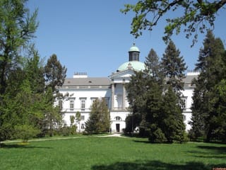
Topoľčianky chateau
Topoľčianky
10.7km
manor, mansion
Hrušov
Hostie
11.3km
castle ruin
Skýcov
Skýcov
13.3km
manor, mansion